Varser geodata
Varser (Gegharkunik) is a populated place; located in Armenia in Asia/Yerevan (GMT+4) time zone. With population of 1,614 people, there are 209 cities with bigger population in this country. Compared to other cities in Armenia, 70.7% of cities are located further ↓South; 74.5% of cities are located further ←West and 86.9% of cities have lower elevation than Varser. Note1


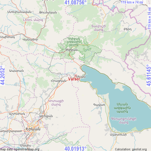
Varser GPS coordinates[2]
40° 33' 19.728" North, 44° 54' 29.952" East
| Map corner | latitude | longitude |
|---|---|---|
| Upper-left | 41.08756°, | 44.2052° |
| Center: | 40.55548°, | 44.90832° |
| Lower-right: | 40.01913°, | 45.61145° |
| Map W x H: | 118.8×118.8 km | = 73.8×73.8mi |
| max Lat: | 41.24358° ⇑29.3% North |
| Varser: | 40.55548° |
| min Lat: | ⇓70.7% South 38.90292° |
| min Long | Varser | max Long |
| 43.74722° | 44.90832° | 46.5446° |
| W 74.5%⇐ | ⇒25.5% E |
Elevation
Elevation of Varser is 1917 m = 6289 ft, and this is 615.5 m = 2019 ft above average elevation for this country.
| Max E: |
2169 m = 7116 ft | 13.1% |
| Varser | 1917 m 6289 ft | |
| Avg. | 1301.5 m = 4270 ft | |
Min E: |
440 m = 1444 ft | 86.9% |
See also: Armenia elevation on elevation.city.
Geographical zone
Varser is located in North temperate zone (between Tropic of Cancer and the Arctic Circle). Distance of this Northern Tropic circle is 1903.4 km =1182.7 mi to South.| Distance of | km | miles | from Varser |
|---|---|---|---|
| North Pole | 5497.7 | 3416.1 | to North |
| Arctic Circle | 2891.8 | 1796.9 | to North |
| Tropic Cancer | 1903.4 | 1182.7 | to South |
| Equator | 4509.3 | 2801.9 | to South |


Nearby cities:
15 places around Varser: (largest is in red/bold)
• Aghavnadzor
18.2 km =11.3 mi,  279°
279°
• Ddmashen
7.4 km =4.6 mi, 282°
• Gagarin
3.7 km =2.3 mi,  242°
242°
• Geghamavan
1.8 km =1.1 mi,  295°
295°
• Gosh
20.9 km =13 mi,  21°
21°
• Hrazdan
13.6 km =8.5 mi, 241°
• Lchap’
17.9 km =11.1 mi,  128°
128°
• Lchashen
4.4 km =2.7 mi,  154°
154°
• Lerrnanist
13.9 km =8.6 mi,  224°
224°
• Sevan
3 km =1.9 mi,  107°
107°
• Solak
19.9 km =12.4 mi, 238°
• Tsaghkadzor
16.1 km =10 mi,  260°
260°
• Tsovagyugh
9.8 km =6.1 mi,  27°
27°
• Tsovazard
15 km =9.3 mi, 126°
• Zovaber
10 km =6.2 mi, 277°
Sources, notices
• [Note1] Compared only with cities in Armenia existing in our database
• [Src1] Map data: © OpenStreetMap contributors (CC-BY-SA)
• [Src2] Other city data from geonames.org with taken over terms of usage.
• [Src3] Geographical zone / Annual Mean Temperature by Robert A. Rohde @ Wikipedia
