N'zeto geodata
N'zeto (Zaire) is a populated place; located in Angola in Africa/Luanda (GMT+1) time zone. With population of 18,352 people, there are 24 cities with bigger population in this country. Compared to other cities in Angola, 91.7% of cities are located further ↓South; 91.7% of cities are located further →East and 80.6% of cities have higher elevation than N'zeto. Note1


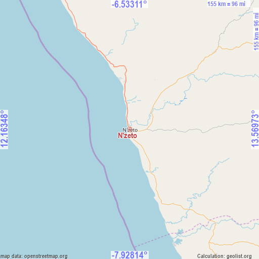
N'zeto GPS coordinates[2]
7° 13' 52.176" South, 12° 51' 59.76" East
| Map corner | latitude | longitude |
|---|---|---|
| Upper-left | -6.53311°, | 12.16348° |
| Center: | -7.23116°, | 12.8666° |
| Lower-right: | -7.92814°, | 13.56973° |
| Map W x H: | 155.1×155.1 km | = 96.4×96.4mi |
| max Lat: | -5.55° ⇑8.3% North |
| N'zeto: | -7.23116° |
| min Lat: | ⇓91.7% South -17.06667° |
| min Long | N'zeto | max Long |
| 12.15222° | 12.8666° | 22.22466° |
| W 8.3%⇐ | ⇒91.7% E |
Elevation
Elevation of N'zeto is 19 m = 62 ft, and this is 949.9 m = 3116 ft below average elevation for this country.
| Max E: |
1895 m = 6217 ft | 80.6% |
| Avg. | 968.9 m = 3179 ft | |
| N'zeto | 19 m = 62 ft | |
Min E: |
1 m = 3 ft | 19.4% |
See also: Angola elevation on elevation.city.
Geographical zone
N'zeto is located in South Torrid zone (between Equator and Tropic of Capricorn). Distance of Equator is 804 km =499.6 mi to North.| Distance of | km | miles | from N'zeto |
|---|---|---|---|
| Equator | 804 | 499.6 | to North |
| Tropic Capricorn | 1801.9 | 1119.6 | to South |
| Antarctic Circle | 6597.1 | 4099.2 | to South |
| South Pole | 9203 | 5718.5 | to South |


Nearby cities:
8 places around N'zeto: (largest is in red/bold)
• Cabinda
200.9 km =124.8 mi,  338°
338°
• Camabatela
296.2 km =184.1 mi,  111°
111°
• Caxito
173.7 km =107.9 mi,  149°
149°
• Luanda
183.1 km =113.8 mi,  167°
167°
• Mbanza Congo
185.7 km =115.4 mi,  54°
54°
• N’dalatando
321.6 km =199.8 mi,  135°
135°
• Soio
133.7 km =83.1 mi, 335°
• Uíge
245.6 km =152.6 mi,  99°
99°
Sources, notices
• [Note1] Compared only with cities in Angola existing in our database
• [Src1] Map data: © OpenStreetMap contributors (CC-BY-SA)
• [Src2] Other city data from geonames.org with taken over terms of usage.
• [Src3] Geographical zone / Annual Mean Temperature by Robert A. Rohde @ Wikipedia
