Luanda geodata
Luanda is a capital of a political entity; located in Angola in Africa/Luanda (GMT+1) time zone. With population of 2,776,168 people, there are 0 cities with bigger population in this country. Compared to other cities in Angola, 77.8% of cities are located further ↓South; 88.9% of cities are located further →East and 75% of cities have higher elevation than Luanda. Note1


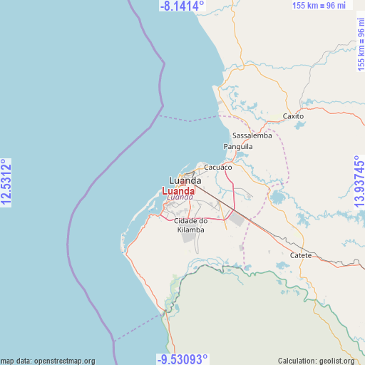
Luanda GPS coordinates[2]
8° 50' 12.552" South, 13° 14' 3.552" East
| Map corner | latitude | longitude |
|---|---|---|
| Upper-left | -8.1414°, | 12.5312° |
| Center: | -8.83682°, | 13.23432° |
| Lower-right: | -9.53093°, | 13.93745° |
| Map W x H: | 154.5×154.5 km | = 96×96mi |
| max Lat: | -5.55° ⇑22.2% North |
| Luanda: | -8.83682° |
| min Lat: | ⇓77.8% South -17.06667° |
| min Long | Luanda | max Long |
| 12.15222° | 13.23432° | 22.22466° |
| W 11.1%⇐ | ⇒88.9% E |
Elevation
Elevation of Luanda is 73 m = 240 ft, and this is 895.9 m = 2939 ft below average elevation for this country.
| Max E: |
1895 m = 6217 ft | 75% |
| Avg. | 968.9 m = 3179 ft | |
| Luanda | 73 m = 240 ft | |
Min E: |
1 m = 3 ft | 25% |
See also: Luanda elevation on elevation.city.
Geographical zone
Luanda is located in South Torrid zone (between Equator and Tropic of Capricorn). Distance of Equator is 982.6 km =610.6 mi to North.| Distance of | km | miles | from Luanda |
|---|---|---|---|
| Equator | 982.6 | 610.6 | to North |
| Tropic Capricorn | 1623.4 | 1008.7 | to South |
| Antarctic Circle | 6418.6 | 3988.3 | to South |
| South Pole | 9024.5 | 5607.6 | to South |


Nearby cities:
15 places around Luanda: (largest is in red/bold)
• Benguela
416.2 km =258.6 mi,  177°
177°
• Cabinda
382.9 km =237.9 mi,  342°
342°
• Camabatela
246.2 km =153 mi,  72°
72°
• Catumbela
401 km =249.2 mi, 175°
• Caxito
55.3 km =34.4 mi,  58°
58°
• Lobito
393.6 km =244.6 mi, 175°
• Malanje
349.8 km =217.4 mi,  102°
102°
• Mbanza Congo
306.5 km =190.5 mi,  21°
21°
• N'zeto
183.1 km =113.8 mi,  347°
347°
• N’dalatando
191.2 km =118.8 mi,  105°
105°
• Quibala
284.7 km =176.9 mi,  137°
137°
• Soio
315.2 km =195.9 mi, 342°
• Sumbe
271.8 km =168.9 mi,  165°
165°
• Uacu Cungo
347.8 km =216.1 mi, 143°
• Uíge
243 km =151 mi, 55°
Sources, notices
• [Note1] Compared only with cities in Angola existing in our database
• [Src1] Map data: © OpenStreetMap contributors (CC-BY-SA)
• [Src2] Other city data from geonames.org with taken over terms of usage.
• [Src3] Geographical zone / Annual Mean Temperature by Robert A. Rohde @ Wikipedia
