Cazaji geodata
Cazaji (Lunda Sul) is a populated place; located in Angola in Africa/Luanda (GMT+1) time zone. With population of 4,764 people, there are 35 cities with bigger population in this country. Compared to other cities in Angola, 61.1% of cities are located further ↓South; 91.7% of cities are located further ←West and 52.8% of cities have lower elevation than Cazaji. Note1


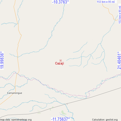
Cazaji GPS coordinates[2]
11° 4' 1.74" South, 20° 42' 5.328" East
| Map corner | latitude | longitude |
|---|---|---|
| Upper-left | -10.3763°, | 19.99836° |
| Center: | -11.06715°, | 20.70148° |
| Lower-right: | -11.75637°, | 21.40461° |
| Map W x H: | 153.4×153.5 km | = 95.3×95.4mi |
| max Lat: | -5.55° ⇑38.9% North |
| Cazaji: | -11.06715° |
| min Lat: | ⇓61.1% South -17.06667° |
| min Long | Cazaji | max Long |
| 12.15222° | 20.70148° | 22.22466° |
| W 91.7%⇐ | ⇒8.3% E |
Elevation
Elevation of Cazaji is 1188 m = 3898 ft, and this is 219.1 m = 719 ft above average elevation for this country.
| Max E: |
1895 m = 6217 ft | 47.2% |
| Cazaji | 1188 m 3898 ft | |
| Avg. | 968.9 m = 3179 ft | |
Min E: |
1 m = 3 ft | 52.8% |
See also: Angola elevation on elevation.city.
Geographical zone
Cazaji is located in South Torrid zone (between Equator and Tropic of Capricorn). Distance of Equator is 1230.6 km =764.7 mi to North.| Distance of | km | miles | from Cazaji |
|---|---|---|---|
| Equator | 1230.6 | 764.7 | to North |
| Tropic Capricorn | 1375.4 | 854.6 | to South |
| Antarctic Circle | 6170.6 | 3834.2 | to South |
| South Pole | 8776.5 | 5453.5 | to South |


Nearby cities:
10 places around Cazaji: (largest is in red/bold)
• Camacupa
366.1 km =227.5 mi,  253°
253°
• Catabola
391.3 km =243.1 mi, 252°
• Chissamba
386.7 km =240.3 mi, 251°
• Cuito
435.5 km =270.6 mi, 250°
• Luau
171.1 km =106.3 mi,  76°
76°
• Lucapa
294.5 km =183 mi,  0°
0°
• Luena
116.9 km =72.6 mi,  227°
227°
• Lumeje
54.4 km =33.8 mi,  170°
170°
• Léua
70.4 km =43.7 mi,  202°
202°
• Saurimo
160 km =99.4 mi,  347°
347°
Sources, notices
• [Note1] Compared only with cities in Angola existing in our database
• [Src1] Map data: © OpenStreetMap contributors (CC-BY-SA)
• [Src2] Other city data from geonames.org with taken over terms of usage.
• [Src3] Geographical zone / Annual Mean Temperature by Robert A. Rohde @ Wikipedia
