General Galarza geodata
General Galarza (Entre Rios) is a populated place; located in Argentina in America/Argentina/Cordoba (GMT-3) time zone. With population of 4,150 people, there are 482 cities with bigger population in this country. Compared to other cities in Argentina, 58.8% of cities are located further ↑North; 72.7% of cities are located further ←West and 82.2% of cities have higher elevation than General Galarza. Note1


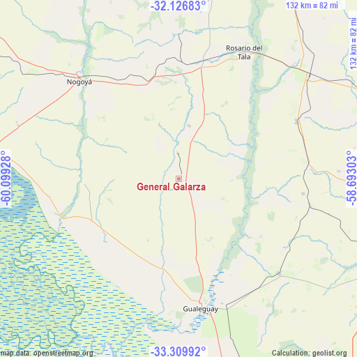
General Galarza GPS coordinates[2]
32° 43' 13.224" South, 59° 23' 46.14" West
| Map corner | latitude | longitude |
|---|---|---|
| Upper-left | -32.12683°, | -60.09928° |
| Center: | -32.72034°, | -59.39615° |
| Lower-right: | -33.30992°, | -58.69303° |
| Map W x H: | 131.5×131.5 km | = 81.7×81.7mi |
| max Lat: | -21.94467° ⇑58.8% North |
| General Galarza: | -32.72034° |
| min Lat: | ⇓41.2% South -54.81084° |
| min Long | General Galarza | max Long |
| -72.88605° | -59.39615° | -53.64581° |
| W 72.7%⇐ | ⇒27.3% E |
Elevation
Elevation of General Galarza is 54 m = 177 ft, and this is 295.3 m = 969 ft below average elevation for this country.
| Max E: |
4040 m = 13255 ft | 82.2% |
| Avg. | 349.3 m = 1146 ft | |
| General Galarza | 54 m = 177 ft | |
Min E: |
-2 m = -7 ft | 17.8% |
See also: Argentina elevation on elevation.city.
Geographical zone
General Galarza is located in South temperate zone (between Tropic of Capricorn and the Antarctic Circle). Distance of this Southern Tropic circle is 1032.2 km =641.4 mi to North.| Distance of | km | miles | from General Galarza |
|---|---|---|---|
| Equator | 3638.2 | 2260.7 | to North |
| Tropic Capricorn | 1032.2 | 641.4 | to North |
| Antarctic Circle | 3763 | 2338.2 | to South |
| South Pole | 6368.9 | 3957.4 | to South |


Nearby cities:
15 places around General Galarza: (largest is in red/bold)
• Aldea San Antonio
65.6 km =40.8 mi,  80°
80°
• Gilbert
48.2 km =30 mi,  64°
64°
• Gobernador Mansilla
19.9 km =12.4 mi,  11°
11°
• Gualeguay
47.5 km =29.5 mi,  170°
170°
• Hernández
72.5 km =45 mi,  305°
305°
• Herrera
78.4 km =48.7 mi,  66°
66°
• Larroque
50.9 km =31.6 mi,  133°
133°
• Lucas González
39.4 km =24.5 mi,  341°
341°
• Maciá
60.9 km =37.8 mi,  359°
359°
• Nogoyá
51.7 km =32.1 mi, 314°
• Rosario del Tala
52 km =32.3 mi,  26°
26°
• Santa Anita
83.4 km =51.8 mi,  43°
43°
• Urdinarrain
47.2 km =29.3 mi,  85°
85°
• Victoria
71.9 km =44.7 mi,  279°
279°
• Villa Mantero
70.7 km =43.9 mi, 59°
Sources, notices
• [Note1] Compared only with cities in Argentina existing in our database
• [Src1] Map data: © OpenStreetMap contributors (CC-BY-SA)
• [Src2] Other city data from geonames.org with taken over terms of usage.
• [Src3] Geographical zone / Annual Mean Temperature by Robert A. Rohde @ Wikipedia
