Guaviraví geodata
Guaviraví (Corrientes) is a populated place; located in Argentina in America/Argentina/Cordoba (GMT-3) time zone. With population of 641 people, there are 781 cities with bigger population in this country. Compared to other cities in Argentina, 66.9% of cities are located further ↓South; 93.1% of cities are located further ←West and 74.5% of cities have higher elevation than Guaviraví. Note1


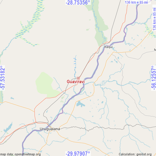
Guaviraví GPS coordinates[2]
29° 22' 5.376" South, 56° 49' 43.284" West
| Map corner | latitude | longitude |
|---|---|---|
| Upper-left | -28.75356°, | -57.53182° |
| Center: | -29.36816°, | -56.82869° |
| Lower-right: | -29.97907°, | -56.12557° |
| Map W x H: | 136.3×136.3 km | = 84.7×84.7mi |
| max Lat: | -21.94467° ⇑33.1% North |
| Guaviraví: | -29.36816° |
| min Lat: | ⇓66.9% South -54.81084° |
| min Long | Guaviraví | max Long |
| -72.88605° | -56.82869° | -53.64581° |
| W 93.1%⇐ | ⇒6.9% E |
Elevation
Elevation of Guaviraví is 70 m = 230 ft, and this is 279.3 m = 916 ft below average elevation for this country.
| Max E: |
4040 m = 13255 ft | 74.5% |
| Avg. | 349.3 m = 1146 ft | |
| Guaviraví | 70 m = 230 ft | |
Min E: |
-2 m = -7 ft | 25.5% |
See also: Argentina elevation on elevation.city.
Geographical zone
Guaviraví is located in South temperate zone (between Tropic of Capricorn and the Antarctic Circle). Distance of this Southern Tropic circle is 659.5 km =409.8 mi to North.| Distance of | km | miles | from Guaviraví |
|---|---|---|---|
| Equator | 3265.4 | 2029 | to North |
| Tropic Capricorn | 659.5 | 409.8 | to North |
| Antarctic Circle | 4135.7 | 2569.8 | to South |
| South Pole | 6741.6 | 4189 | to South |


Nearby cities:
15 places around Guaviraví: (largest is in red/bold)
• Alvear
40.5 km =25.2 mi,  41°
41°
• Bonpland
76.6 km =47.6 mi,  229°
229°
• Colonia Carlos Pellegrini
98.5 km =61.2 mi,  340°
340°
• Concepción
149.7 km =93 mi,  316°
316°
• Curuzú Cuatiá
127.6 km =79.3 mi,  248°
248°
• Felipe Yofré
149.4 km =92.8 mi,  281°
281°
• La Cruz
28.1 km =17.5 mi, 39°
• Libertad
121.7 km =75.6 mi, 231°
• Mariano I. Loza
132.3 km =82.2 mi,  269°
269°
• Mercedes
122.6 km =76.2 mi, 279°
• Monte Caseros
125.5 km =78 mi,  218°
218°
• Paso de los Libres
45.8 km =28.5 mi,  213°
213°
• Santo Tomé
119 km =73.9 mi, 40°
• Tapebicuá
20.9 km =13 mi, 222°
• Yapeyú
11.3 km =7 mi,  174°
174°
Sources, notices
• [Note1] Compared only with cities in Argentina existing in our database
• [Src1] Map data: © OpenStreetMap contributors (CC-BY-SA)
• [Src2] Other city data from geonames.org with taken over terms of usage.
• [Src3] Geographical zone / Annual Mean Temperature by Robert A. Rohde @ Wikipedia
