Alvear geodata
Alvear (Corrientes) is a seat of a second-order administrative division; located in Argentina in America/Argentina/Cordoba (GMT-3) time zone. With population of 7,917 people, there are 341 cities with bigger population in this country. Compared to other cities in Argentina, 68.4% of cities are located further ↓South; 93.7% of cities are located further ←West and 77.4% of cities have higher elevation than Alvear. Note1


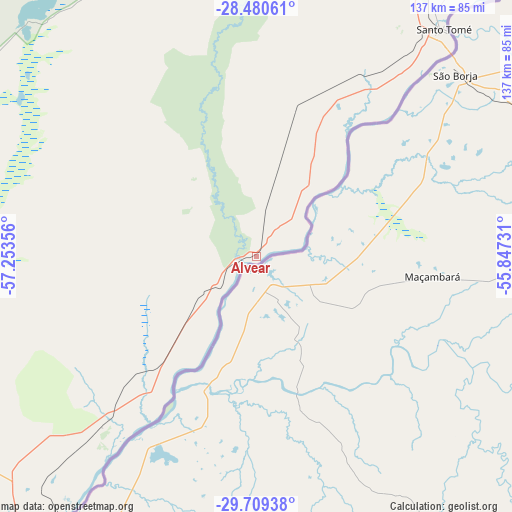
Alvear GPS coordinates[2]
29° 5' 48.588" South, 56° 33' 1.548" West
| Map corner | latitude | longitude |
|---|---|---|
| Upper-left | -28.48061°, | -57.25356° |
| Center: | -29.09683°, | -56.55043° |
| Lower-right: | -29.70938°, | -55.84731° |
| Map W x H: | 136.6×136.6 km | = 84.9×84.9mi |
| max Lat: | -21.94467° ⇑31.6% North |
| Alvear: | -29.09683° |
| min Lat: | ⇓68.4% South -54.81084° |
| min Long | Alvear | max Long |
| -72.88605° | -56.55043° | -53.64581° |
| W 93.7%⇐ | ⇒6.3% E |
Elevation
Elevation of Alvear is 65 m = 213 ft, and this is 284.3 m = 933 ft below average elevation for this country.
| Max E: |
4040 m = 13255 ft | 77.4% |
| Avg. | 349.3 m = 1146 ft | |
| Alvear | 65 m = 213 ft | |
Min E: |
-2 m = -7 ft | 22.6% |
See also: Argentina elevation on elevation.city.
Geographical zone
Alvear is located in South temperate zone (between Tropic of Capricorn and the Antarctic Circle). Distance of this Southern Tropic circle is 629.3 km =391 mi to North.| Distance of | km | miles | from Alvear |
|---|---|---|---|
| Equator | 3235.3 | 2010.3 | to North |
| Tropic Capricorn | 629.3 | 391 | to North |
| Antarctic Circle | 4165.9 | 2588.6 | to South |
| South Pole | 6771.8 | 4207.8 | to South |


Nearby cities:
15 places around Alvear: (largest is in red/bold)
• Apóstoles
152.8 km =94.9 mi,  30°
30°
• Azara
143.2 km =89 mi,  36°
36°
• Bonpland
116.9 km =72.6 mi,  226°
226°
• Colonia Carlos Pellegrini
87.1 km =54.1 mi,  315°
315°
• Concepción
152.1 km =94.5 mi,  301°
301°
• Garruchos
135 km =83.9 mi, 40°
• Gobernador Virasora
126.9 km =78.9 mi,  23°
23°
• Guaviraví
40.5 km =25.2 mi,  221°
221°
• La Cruz
12.5 km =7.8 mi, 226°
• Mercedes
148.4 km =92.2 mi,  266°
266°
• Paso de los Libres
86 km =53.4 mi, 217°
• Santo Tomé
78.5 km =48.8 mi, 39°
• Tapebicuá
61.4 km =38.2 mi, 222°
• Tres Capones
152.4 km =94.7 mi, 37°
• Yapeyú
48.9 km =30.4 mi,  212°
212°
Sources, notices
• [Note1] Compared only with cities in Argentina existing in our database
• [Src1] Map data: © OpenStreetMap contributors (CC-BY-SA)
• [Src2] Other city data from geonames.org with taken over terms of usage.
• [Src3] Geographical zone / Annual Mean Temperature by Robert A. Rohde @ Wikipedia
