Yapeyú geodata
Yapeyú (Corrientes) is a populated place; located in Argentina in America/Argentina/Cordoba (GMT-3) time zone. With population of 2,124 people, there are 630 cities with bigger population in this country. Compared to other cities in Argentina, 66.2% of cities are located further ↓South; 93.2% of cities are located further ←West and 78.2% of cities have higher elevation than Yapeyú. Note1


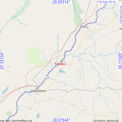
Yapeyú GPS coordinates[2]
29° 28' 8.904" South, 56° 49' 6.276" West
| Map corner | latitude | longitude |
|---|---|---|
| Upper-left | -28.85514°, | -57.52154° |
| Center: | -29.46914°, | -56.81841° |
| Lower-right: | -30.07944°, | -56.11529° |
| Map W x H: | 136.1×136.1 km | = 84.6×84.6mi |
| max Lat: | -21.94467° ⇑33.8% North |
| Yapeyú: | -29.46914° |
| min Lat: | ⇓66.2% South -54.81084° |
| min Long | Yapeyú | max Long |
| -72.88605° | -56.81841° | -53.64581° |
| W 93.2%⇐ | ⇒6.8% E |
Elevation
Elevation of Yapeyú is 64 m = 210 ft, and this is 285.3 m = 936 ft below average elevation for this country.
| Max E: |
4040 m = 13255 ft | 78.2% |
| Avg. | 349.3 m = 1146 ft | |
| Yapeyú | 64 m = 210 ft | |
Min E: |
-2 m = -7 ft | 21.8% |
See also: Argentina elevation on elevation.city.
Geographical zone
Yapeyú is located in South temperate zone (between Tropic of Capricorn and the Antarctic Circle). Distance of this Southern Tropic circle is 670.7 km =416.8 mi to North.| Distance of | km | miles | from Yapeyú |
|---|---|---|---|
| Equator | 3276.7 | 2036 | to North |
| Tropic Capricorn | 670.7 | 416.8 | to North |
| Antarctic Circle | 4124.5 | 2562.8 | to South |
| South Pole | 6730.4 | 4182.1 | to South |


Nearby cities:
15 places around Yapeyú: (largest is in red/bold)
• Alvear
48.9 km =30.4 mi,  32°
32°
• Bonpland
70.6 km =43.9 mi,  236°
236°
• Colonia Carlos Pellegrini
109.4 km =68 mi,  341°
341°
• Curuzú Cuatiá
124.7 km =77.5 mi,  253°
253°
• Felipe Yofré
152.9 km =95 mi,  285°
285°
• Guaviraví
11.3 km =7 mi,  354°
354°
• Juan Pujol
145.4 km =90.3 mi,  223°
223°
• La Cruz
36.9 km =22.9 mi, 27°
• Libertad
115.9 km =72 mi, 236°
• Mariano I. Loza
133.7 km =83.1 mi,  274°
274°
• Mercedes
125.9 km =78.2 mi,  284°
284°
• Monte Caseros
117.6 km =73.1 mi, 222°
• Paso de los Libres
37.6 km =23.4 mi, 223°
• Santo Tomé
127.2 km =79 mi,  36°
36°
• Tapebicuá
15.7 km =9.8 mi, 254°
Sources, notices
• [Note1] Compared only with cities in Argentina existing in our database
• [Src1] Map data: © OpenStreetMap contributors (CC-BY-SA)
• [Src2] Other city data from geonames.org with taken over terms of usage.
• [Src3] Geographical zone / Annual Mean Temperature by Robert A. Rohde @ Wikipedia
