Charadai geodata
Charadai (Chaco) is a seat of a second-order administrative division; located in Argentina in America/Argentina/Cordoba (GMT-3) time zone. With population of 2,538 people, there are 586 cities with bigger population in this country. Compared to other cities in Argentina, 78.1% of cities are located further ↓South; 68.9% of cities are located further ←West and 76.5% of cities have higher elevation than Charadai. Note1


Charadai GPS coordinates[2]
27° 39' 18.108" South, 59° 51' 46.476" West
| Map corner | latitude | longitude |
|---|---|---|
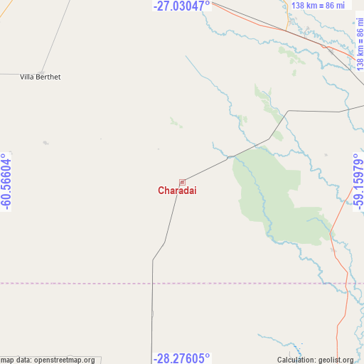
| Upper-left | -27.03047°, | -60.56604° |
| Center: | -27.65503°, | -59.86291° |
| Lower-right: | -28.27605°, | -59.15979° |
| Map W x H: | 138.5×138.5 km | = 86.1×86.1mi |
| max Lat: | -21.94467° ⇑21.9% North |
| Charadai: | -27.65503° |
| min Lat: | ⇓78.1% South -54.81084° |
| min Long | Charadai | max Long |
| -72.88605° | -59.86291° | -53.64581° |
| W 68.9%⇐ | ⇒31.1% E |
Elevation
Elevation of Charadai is 67 m = 220 ft, and this is 282.3 m = 926 ft below average elevation for this country.
| Max E: |
4040 m = 13255 ft | 76.5% |
| Avg. | 349.3 m = 1146 ft | |
| Charadai | 67 m = 220 ft | |
Min E: |
-2 m = -7 ft | 23.5% |
See also: Argentina elevation on elevation.city.
Geographical zone
Charadai is located in South temperate zone (between Tropic of Capricorn and the Antarctic Circle). Distance of this Southern Tropic circle is 469 km =291.4 mi to North.| Distance of | km | miles | from Charadai |
|---|---|---|---|
| Equator | 3075 | 1910.7 | to North |
| Tropic Capricorn | 469 | 291.4 | to North |
| Antarctic Circle | 4326.2 | 2688.2 | to South |
| South Pole | 6932.1 | 4307.4 | to South |


Nearby cities:
15 places around Charadai: (largest is in red/bold)
• Basail
62.6 km =38.9 mi,  114°
114°
• Colonia Elisa
87.5 km =54.4 mi,  22°
22°
• Coté-Lai
31.1 km =19.3 mi,  56°
56°
• Fontana
86.8 km =53.9 mi,  72°
72°
• La Escondida
73.4 km =45.6 mi,  33°
33°
• La Verde
76.1 km =47.3 mi,  39°
39°
• Lapachito
72.4 km =45 mi, 40°
• Machagai
83.1 km =51.6 mi,  347°
347°
• Makallé
75.6 km =47 mi,  48°
48°
• Presidencia de la Plaza
72.7 km =45.2 mi,  1°
1°
• Puerto Tirol
83.2 km =51.7 mi, 67°
• Resistencia
89.3 km =55.5 mi,  75°
75°
• Samuhú
54.2 km =33.7 mi,  285°
285°
• Villa Berthet
67.6 km =42 mi,  306°
306°
• Villa Ángela
84.5 km =52.5 mi,  276°
276°
Sources, notices
• [Note1] Compared only with cities in Argentina existing in our database
• [Src1] Map data: © OpenStreetMap contributors (CC-BY-SA)
• [Src2] Other city data from geonames.org with taken over terms of usage.
• [Src3] Geographical zone / Annual Mean Temperature by Robert A. Rohde @ Wikipedia
