La Paz geodata
La Paz (Mendoza) is a seat of a second-order administrative division; located in Argentina in America/Argentina/Mendoza (GMT-3) time zone. In our database, there are 785 cities with bigger population. Compared to other cities in Argentina, 66.2% of cities are located further ↑North; 88% of cities are located further →East and 77.7% of cities have lower elevation than La Paz. Note1


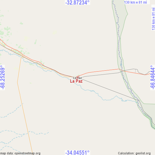
La Paz GPS coordinates[2]
33° 27' 39.276" South, 67° 32' 58.416" West
| Map corner | latitude | longitude |
|---|---|---|
| Upper-left | -32.87234°, | -68.25269° |
| Center: | -33.46091°, | -67.54956° |
| Lower-right: | -34.04551°, | -66.84644° |
| Map W x H: | 130.4×130.4 km | = 81×81mi |
| max Lat: | -21.94467° ⇑66.2% North |
| La Paz: | -33.46091° |
| min Lat: | ⇓33.8% South -54.81084° |
| min Long | La Paz | max Long |
| -72.88605° | -67.54956° | -53.64581° |
| W 12%⇐ | ⇒88% E |
Elevation
Elevation of La Paz is 510 m = 1673 ft, and this is 160.7 m = 527 ft above average elevation for this country.
| Max E: |
4040 m = 13255 ft | 22.3% |
| La Paz | 510 m 1673 ft | |
| Avg. | 349.3 m = 1146 ft | |
Min E: |
-2 m = -7 ft | 77.7% |
See also: Argentina elevation on elevation.city.
Geographical zone
La Paz is located in South temperate zone (between Tropic of Capricorn and the Antarctic Circle). Distance of this Southern Tropic circle is 1114.6 km =692.6 mi to North.| Distance of | km | miles | from La Paz |
|---|---|---|---|
| Equator | 3720.5 | 2311.8 | to North |
| Tropic Capricorn | 1114.6 | 692.6 | to North |
| Antarctic Circle | 3680.7 | 2287.1 | to South |
| South Pole | 6286.6 | 3906.3 | to South |


Nearby cities:
15 places around La Paz: (largest is in red/bold)
• General Lavalle
127.1 km =79 mi,  310°
310°
• Godoy Cruz
133.5 km =83 mi,  296°
296°
• Junín
93.1 km =57.8 mi,  291°
291°
• La Punta
119 km =73.9 mi,  74°
74°
• Las Heras
136.9 km =85.1 mi, 299°
• Luján de Cuyo
132.3 km =82.2 mi, 290°
• Maipú
126.7 km =78.7 mi, 294°
• Mendoza
134.7 km =83.7 mi, 298°
• Rivadavia
89.8 km =55.8 mi, 289°
• San Luis
114.2 km =71 mi,  80°
80°
• San Martín
95.3 km =59.2 mi, 296°
• Santa Rosa
60.3 km =37.5 mi, 292°
• Tunuyán
136.5 km =84.8 mi,  264°
264°
• Villa General Roca
135.3 km =84.1 mi,  49°
49°
• Villa Nueva
130.6 km =81.2 mi, 298°
Sources, notices
• [Note1] Compared only with cities in Argentina existing in our database
• [Src1] Map data: © OpenStreetMap contributors (CC-BY-SA)
• [Src2] Other city data from geonames.org with taken over terms of usage.
• [Src3] Geographical zone / Annual Mean Temperature by Robert A. Rohde @ Wikipedia
