Buchardo geodata
Buchardo (Cordoba) is a populated place; located in Argentina in America/Argentina/Cordoba (GMT-3) time zone. With population of 1,756 people, there are 667 cities with bigger population in this country. Compared to other cities in Argentina, 74.9% of cities are located further ↑North; 55.8% of cities are located further →East and 52% of cities have higher elevation than Buchardo. Note1


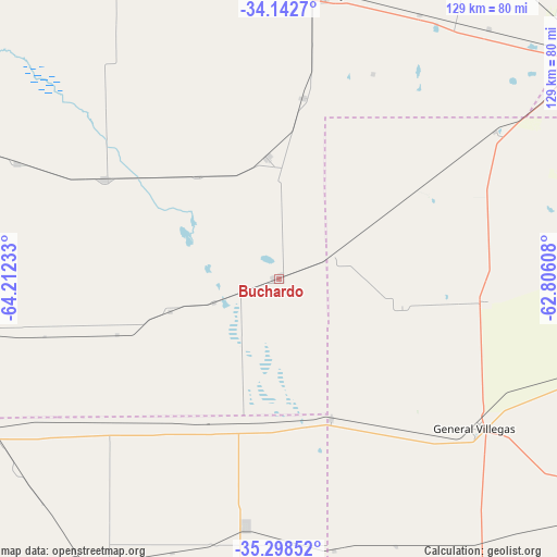
Buchardo GPS coordinates[2]
34° 43' 21.468" South, 63° 30' 33.12" West
| Map corner | latitude | longitude |
|---|---|---|
| Upper-left | -34.1427°, | -64.21233° |
| Center: | -34.72263°, | -63.5092° |
| Lower-right: | -35.29852°, | -62.80608° |
| Map W x H: | 128.5×128.5 km | = 79.8×79.8mi |
| max Lat: | -21.94467° ⇑74.9% North |
| Buchardo: | -34.72263° |
| min Lat: | ⇓25.1% South -54.81084° |
| min Long | Buchardo | max Long |
| -72.88605° | -63.5092° | -53.64581° |
| W 44.2%⇐ | ⇒55.8% E |
Elevation
Elevation of Buchardo is 133 m = 436 ft, and this is 216.3 m = 710 ft below average elevation for this country.
| Max E: |
4040 m = 13255 ft | 52% |
| Avg. | 349.3 m = 1146 ft | |
| Buchardo | 133 m = 436 ft | |
Min E: |
-2 m = -7 ft | 48% |
See also: Argentina elevation on elevation.city.
Geographical zone
Buchardo is located in South temperate zone (between Tropic of Capricorn and the Antarctic Circle). Distance of this Southern Tropic circle is 1254.9 km =779.8 mi to North.| Distance of | km | miles | from Buchardo |
|---|---|---|---|
| Equator | 3860.8 | 2399 | to North |
| Tropic Capricorn | 1254.9 | 779.8 | to North |
| Antarctic Circle | 3540.4 | 2199.9 | to South |
| South Pole | 6146.3 | 3819.1 | to South |


Nearby cities:
15 places around Buchardo: (largest is in red/bold)
• Alta Italia
87.5 km =54.4 mi,  219°
219°
• Bernardo Larroudé
34.2 km =21.3 mi,  191°
191°
• Florentino Ameghino
96.1 km =59.7 mi,  98°
98°
• General Levalle
87.4 km =54.3 mi,  334°
334°
• General Villegas
56.9 km =35.4 mi,  127°
127°
• Huinca Renancó
80.2 km =49.8 mi,  260°
260°
• Intendente Alvear
57.3 km =35.6 mi, 187°
• Italó
26.1 km =16.2 mi,  252°
252°
• Laboulaye
67.1 km =41.7 mi,  9°
9°
• Mattaldi
66.3 km =41.2 mi,  293°
293°
• Realicó
75.6 km =47 mi,  242°
242°
• Rufino
88.8 km =55.2 mi,  55°
55°
• Santa Magdalena
45.9 km =28.5 mi,  299°
299°
• Serrano
28.2 km =17.5 mi,  354°
354°
• Tres Algarrobos
85.1 km =52.9 mi, 128°
Sources, notices
• [Note1] Compared only with cities in Argentina existing in our database
• [Src1] Map data: © OpenStreetMap contributors (CC-BY-SA)
• [Src2] Other city data from geonames.org with taken over terms of usage.
• [Src3] Geographical zone / Annual Mean Temperature by Robert A. Rohde @ Wikipedia
