General Villegas geodata
General Villegas (Buenos Aires) is a seat of a second-order administrative division; located in Argentina in America/Argentina/Buenos_Aires (GMT-3) time zone. With population of 16,270 people, there are 212 cities with bigger population in this country. Compared to other cities in Argentina, 77.9% of cities are located further ↑North; 52.3% of cities are located further →East and 58.7% of cities have higher elevation than General Villegas. Note1


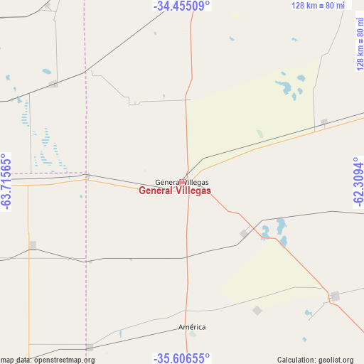
General Villegas GPS coordinates[2]
35° 1' 58.26" South, 63° 0' 45.072" West
| Map corner | latitude | longitude |
|---|---|---|
| Upper-left | -34.45509°, | -63.71565° |
| Center: | -35.03285°, | -63.01252° |
| Lower-right: | -35.60655°, | -62.3094° |
| Map W x H: | 128×128 km | = 79.5×79.5mi |
| max Lat: | -21.94467° ⇑77.9% North |
| General Villegas: | -35.03285° |
| min Lat: | ⇓22.1% South -54.81084° |
| min Long | General Villega | max Long |
| -72.88605° | -63.01252° | -53.64581° |
| W 47.7%⇐ | ⇒52.3% E |
Elevation
Elevation of General Villegas is 112 m = 367 ft, and this is 237.3 m = 779 ft below average elevation for this country.
| Max E: |
4040 m = 13255 ft | 58.7% |
| Avg. | 349.3 m = 1146 ft | |
| General Villegas | 112 m = 367 ft | |
Min E: |
-2 m = -7 ft | 41.3% |
See also: Argentina elevation on elevation.city.
Geographical zone
General Villegas is located in South temperate zone (between Tropic of Capricorn and the Antarctic Circle). Distance of this Southern Tropic circle is 1289.4 km =801.2 mi to North.| Distance of | km | miles | from General Villegas |
|---|---|---|---|
| Equator | 3895.3 | 2420.4 | to North |
| Tropic Capricorn | 1289.4 | 801.2 | to North |
| Antarctic Circle | 3505.9 | 2178.5 | to South |
| South Pole | 6111.8 | 3797.7 | to South |


Nearby cities:
15 places around General Villegas: (largest is in red/bold)
• Alta Italia
105.6 km =65.6 mi,  251°
251°
• Bernardo Larroudé
51.9 km =32.2 mi,  271°
271°
• Buchardo
56.9 km =35.4 mi,  307°
307°
• Carlos Tejedor
67 km =41.6 mi,  126°
126°
• Florentino Ameghino
54 km =33.6 mi,  67°
67°
• General Pico
96.8 km =60.1 mi,  224°
224°
• General Pinto
106.5 km =66.2 mi, 73°
• Intendente Alvear
57.2 km =35.5 mi, 247°
• Italó
75.1 km =46.7 mi,  290°
290°
• Laboulaye
106.6 km =66.2 mi,  341°
341°
• Rufino
89.3 km =55.5 mi,  17°
17°
• Santa Magdalena
102.6 km =63.8 mi,  303°
303°
• Serrano
78.9 km =49 mi,  322°
322°
• Trenque Lauquen
107.2 km =66.6 mi,  166°
166°
• Tres Algarrobos
28.2 km =17.5 mi, 129°
Sources, notices
• [Note1] Compared only with cities in Argentina existing in our database
• [Src1] Map data: © OpenStreetMap contributors (CC-BY-SA)
• [Src2] Other city data from geonames.org with taken over terms of usage.
• [Src3] Geographical zone / Annual Mean Temperature by Robert A. Rohde @ Wikipedia
