Chepes geodata
Chepes (La Rioja) is a seat of a second-order administrative division; located in Argentina in America/Argentina/La_Rioja (GMT-3) time zone. In our database, there are 785 cities with bigger population. Compared to other cities in Argentina, 56.1% of cities are located further ↓South; 84.7% of cities are located further →East and 83.4% of cities have lower elevation than Chepes. Note1


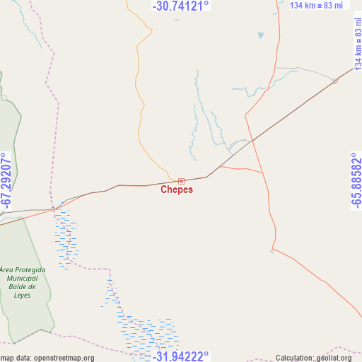
Chepes GPS coordinates[2]
31° 20' 37.068" South, 66° 35' 20.184" West
| Map corner | latitude | longitude |
|---|---|---|
| Upper-left | -30.74121°, | -67.29207° |
| Center: | -31.34363°, | -66.58894° |
| Lower-right: | -31.94222°, | -65.88582° |
| Map W x H: | 133.5×133.5 km | = 83×83mi |
| max Lat: | -21.94467° ⇑43.9% North |
| Chepes: | -31.34363° |
| min Lat: | ⇓56.1% South -54.81084° |
| min Long | Chepes | max Long |
| -72.88605° | -66.58894° | -53.64581° |
| W 15.3%⇐ | ⇒84.7% E |
Elevation
Elevation of Chepes is 644 m = 2113 ft, and this is 294.7 m = 967 ft above average elevation for this country.
| Max E: |
4040 m = 13255 ft | 16.6% |
| Chepes | 644 m 2113 ft | |
| Avg. | 349.3 m = 1146 ft | |
Min E: |
-2 m = -7 ft | 83.4% |
See also: Argentina elevation on elevation.city.
Geographical zone
Chepes is located in South temperate zone (between Tropic of Capricorn and the Antarctic Circle). Distance of this Southern Tropic circle is 879.2 km =546.3 mi to North.| Distance of | km | miles | from Chepes |
|---|---|---|---|
| Equator | 3485.1 | 2165.5 | to North |
| Tropic Capricorn | 879.2 | 546.3 | to North |
| Antarctic Circle | 3916.1 | 2433.4 | to South |
| South Pole | 6522 | 4052.6 | to South |


Nearby cities:
15 places around Chepes: (largest is in red/bold)
• Candelaria
107.6 km =66.9 mi,  137°
137°
• Castro Barros
118.2 km =73.4 mi,  44°
44°
• Chamical
112.5 km =69.9 mi,  13°
13°
• Libertador General San Martín
146.7 km =91.2 mi, 143°
• Luján
129.4 km =80.4 mi,  151°
151°
• Malanzán
60 km =37.3 mi,  358°
358°
• Milagro
68 km =42.3 mi,  56°
56°
• Olta
85.1 km =52.9 mi,  21°
21°
• Salsacate
142.4 km =88.5 mi,  88°
88°
• San Agustín de Valle Fértil
115.1 km =71.5 mi,  313°
313°
• San Carlos
142.5 km =88.5 mi,  82°
82°
• San Francisco del Monte de Oro
146.2 km =90.8 mi,  162°
162°
• Serrezuela
138.9 km =86.3 mi, 55°
• Tama
93.1 km =57.8 mi,  3°
3°
• Ulapes
42.1 km =26.2 mi,  127°
127°
Sources, notices
• [Note1] Compared only with cities in Argentina existing in our database
• [Src1] Map data: © OpenStreetMap contributors (CC-BY-SA)
• [Src2] Other city data from geonames.org with taken over terms of usage.
• [Src3] Geographical zone / Annual Mean Temperature by Robert A. Rohde @ Wikipedia
