Luján geodata
Luján (San Luis) is a populated place; located in Argentina in America/Argentina/San_Luis (GMT-3) time zone. With population of 1,896 people, there are 656 cities with bigger population in this country. Compared to other cities in Argentina, 55.4% of cities are located further ↑North; 81.6% of cities are located further →East and 82.3% of cities have lower elevation than Luján. Note1


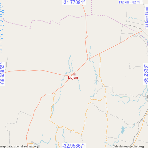
Luján GPS coordinates[2]
32° 22' 0.264" South, 65° 56' 11.112" West
| Map corner | latitude | longitude |
|---|---|---|
| Upper-left | -31.77091°, | -66.63955° |
| Center: | -32.36674°, | -65.93642° |
| Lower-right: | -32.95867°, | -65.2333° |
| Map W x H: | 132.1×132.1 km | = 82.1×82.1mi |
| max Lat: | -21.94467° ⇑55.4% North |
| Luján: | -32.36674° |
| min Lat: | ⇓44.6% South -54.81084° |
| min Long | Luján | max Long |
| -72.88605° | -65.93642° | -53.64581° |
| W 18.4%⇐ | ⇒81.6% E |
Elevation
Elevation of Luján is 616 m = 2021 ft, and this is 266.7 m = 875 ft above average elevation for this country.
| Max E: |
4040 m = 13255 ft | 17.7% |
| Luján | 616 m 2021 ft | |
| Avg. | 349.3 m = 1146 ft | |
Min E: |
-2 m = -7 ft | 82.3% |
See also: Argentina elevation on elevation.city.
Geographical zone
Luján is located in South temperate zone (between Tropic of Capricorn and the Antarctic Circle). Distance of this Southern Tropic circle is 992.9 km =617 mi to North.| Distance of | km | miles | from Luján |
|---|---|---|---|
| Equator | 3598.8 | 2236.2 | to North |
| Tropic Capricorn | 992.9 | 617 | to North |
| Antarctic Circle | 3802.3 | 2362.6 | to South |
| South Pole | 6408.2 | 3981.9 | to South |


Nearby cities:
15 places around Luján: (largest is in red/bold)
• Candelaria
35.6 km =22.1 mi,  17°
17°
• Concarán
68.5 km =42.6 mi,  108°
108°
• La Punta
97.4 km =60.5 mi,  201°
201°
• La Toma
81.7 km =50.8 mi,  159°
159°
• Libertador General San Martín
24.9 km =15.5 mi,  101°
101°
• Merlo
86.7 km =53.9 mi,  88°
88°
• Naschel
80.6 km =50.1 mi,  139°
139°
• San Francisco del Monte de Oro
31.3 km =19.4 mi,  214°
214°
• San Luis
109.7 km =68.2 mi, 199°
• Santa Rosa del Conlara
68.9 km =42.8 mi, 87°
• Tilisarao
72.9 km =45.3 mi,  123°
123°
• Ulapes
92.6 km =57.5 mi,  342°
342°
• Villa Dolores
84.5 km =52.5 mi,  56°
56°
• Villa General Roca
58.5 km =36.4 mi,  235°
235°
• Villa Las Rosas
95.1 km =59.1 mi, 60°
Sources, notices
• [Note1] Compared only with cities in Argentina existing in our database
• [Src1] Map data: © OpenStreetMap contributors (CC-BY-SA)
• [Src2] Other city data from geonames.org with taken over terms of usage.
• [Src3] Geographical zone / Annual Mean Temperature by Robert A. Rohde @ Wikipedia
