Candelaria geodata
Candelaria (San Luis) is a populated place; located in Argentina in America/Argentina/San_Luis (GMT-3) time zone. With population of 2,269 people, there are 610 cities with bigger population in this country. Compared to other cities in Argentina, 52.4% of cities are located further ↑North; 81% of cities are located further →East and 73.7% of cities have lower elevation than Candelaria. Note1


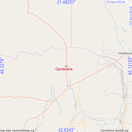
Candelaria GPS coordinates[2]
32° 3' 37.296" South, 65° 49' 29.172" West
| Map corner | latitude | longitude |
|---|---|---|
| Upper-left | -31.46253°, | -66.5279° |
| Center: | -32.06036°, | -65.82477° |
| Lower-right: | -32.6543°, | -65.12165° |
| Map W x H: | 132.5×132.5 km | = 82.3×82.3mi |
| max Lat: | -21.94467° ⇑52.4% North |
| Candelaria: | -32.06036° |
| min Lat: | ⇓47.6% South -54.81084° |
| min Long | Candelaria | max Long |
| -72.88605° | -65.82477° | -53.64581° |
| W 19%⇐ | ⇒81% E |
Elevation
Elevation of Candelaria is 410 m = 1345 ft, and this is 60.7 m = 199 ft above average elevation for this country.
| Max E: |
4040 m = 13255 ft | 26.3% |
| Candelaria | 410 m 1345 ft | |
| Avg. | 349.3 m = 1146 ft | |
Min E: |
-2 m = -7 ft | 73.7% |
See also: Argentina elevation on elevation.city.
Geographical zone
Candelaria is located in South temperate zone (between Tropic of Capricorn and the Antarctic Circle). Distance of this Southern Tropic circle is 958.9 km =595.8 mi to North.| Distance of | km | miles | from Candelaria |
|---|---|---|---|
| Equator | 3564.8 | 2215.1 | to North |
| Tropic Capricorn | 958.9 | 595.8 | to North |
| Antarctic Circle | 3836.4 | 2383.8 | to South |
| South Pole | 6442.3 | 4003.1 | to South |


Nearby cities:
15 places around Candelaria: (largest is in red/bold)
• Concarán
78 km =48.5 mi,  135°
135°
• La Cumbrecita
100.8 km =62.6 mi,  79°
79°
• Libertador General San Martín
41.4 km =25.7 mi,  160°
160°
• Luján
35.6 km =22.1 mi,  197°
197°
• Merlo
82.5 km =51.3 mi,  112°
112°
• Mina Clavero
86 km =53.4 mi,  63°
63°
• Naschel
104.1 km =64.7 mi, 156°
• San Francisco del Monte de Oro
66.1 km =41.1 mi,  205°
205°
• Santa Rosa del Conlara
66.4 km =41.3 mi,  118°
118°
• Tilisarao
90 km =55.9 mi,  146°
146°
• Ulapes
66.7 km =41.4 mi,  324°
324°
• Villa Cura Brochero
85.8 km =53.3 mi, 62°
• Villa Dolores
61.2 km =38 mi, 77°
• Villa General Roca
89.3 km =55.5 mi,  221°
221°
• Villa Las Rosas
73.7 km =45.8 mi, 80°
Sources, notices
• [Note1] Compared only with cities in Argentina existing in our database
• [Src1] Map data: © OpenStreetMap contributors (CC-BY-SA)
• [Src2] Other city data from geonames.org with taken over terms of usage.
• [Src3] Geographical zone / Annual Mean Temperature by Robert A. Rohde @ Wikipedia
