Langau geodata
Langau (Lower Austria) is a seat of a third-order administrative division; located in Austria in Europe/Vienna (GMT+2) time zone. With population of 627 people, there are 2044 cities with bigger population in this country. Compared to other cities in Austria, 99.4% of cities are located further ↓South; 72.5% of cities are located further ←West and 50.8% of cities have higher elevation than Langau. Note1


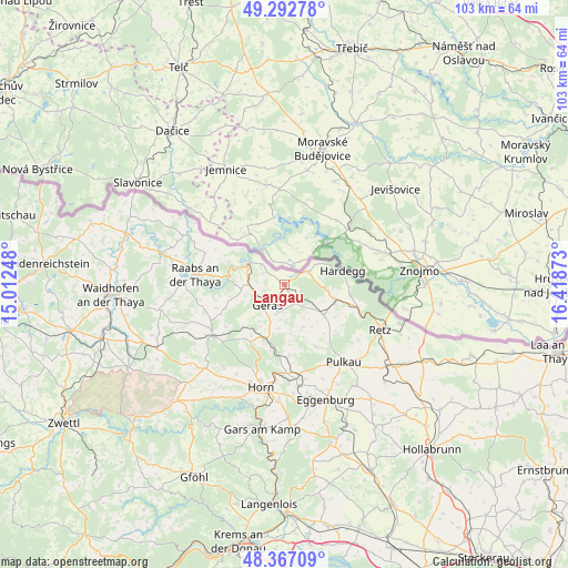
Langau GPS coordinates[2]
48° 49' 55.452" North, 15° 42' 56.16" East
| Map corner | latitude | longitude |
|---|---|---|
| Upper-left | 49.29278°, | 15.01248° |
| Center: | 48.83207°, | 15.7156° |
| Lower-right: | 48.36709°, | 16.41873° |
| Map W x H: | 102.9×102.9 km | = 63.9×63.9mi |
| max Lat: | 48.98333° ⇑0.6% North |
| Langau: | 48.83207° |
| min Lat: | ⇓99.4% South 46.48841° |
| min Long | Langau | max Long |
| 9.57802° | 15.7156° | 17.1° |
| W 72.5%⇐ | ⇒27.5% E |
Elevation
Elevation of Langau is 446 m = 1463 ft, and this is 59.5 m = 195 ft below average elevation for this country.
| Max E: |
2140 m = 7021 ft | 50.8% |
| Avg. | 505.5 m = 1658 ft | |
| Langau | 446 m = 1463 ft | |
Min E: |
118 m = 387 ft | 49.2% |
See also: Austria elevation on elevation.city.
Geographical zone
Langau is located in North temperate zone (between Tropic of Cancer and the Arctic Circle). Distance of this North polar circle is 1971.6 km =1225.1 mi to North.| Distance of | km | miles | from Langau |
|---|---|---|---|
| North Pole | 4577.4 | 2844.3 | to North |
| Arctic Circle | 1971.6 | 1225.1 | to North |
| Tropic Cancer | 2823.7 | 1754.6 | to South |
| Equator | 5429.6 | 3373.8 | to South |


Nearby cities:
15 places around Langau: (largest is in red/bold)
• Brunn an der Wild
21 km =13 mi,  223°
223°
• Drosendorf
8 km =5 mi,  299°
299°
• Frauenhofen
18.8 km =11.7 mi,  199°
199°
• Geras
5 km =3.1 mi, 219°
• Hardegg
10 km =6.2 mi,  78°
78°
• Horn
19.3 km =12 mi,  192°
192°
• Japons
11.6 km =7.2 mi,  247°
247°
• Pernegg
13.2 km =8.2 mi,  213°
213°
• Pulkau
17.7 km =11 mi,  143°
143°
• Raabs an der Thaya
15.9 km =9.9 mi,  277°
277°
• Retz
19.4 km =12.1 mi,  115°
115°
• Schrattenthal
20 km =12.4 mi, 137°
• Sigmundsherberg
16.7 km =10.4 mi,  171°
171°
• Unternalb
20.4 km =12.7 mi, 119°
• Weitersfeld
9.1 km =5.7 mi,  128°
128°
Sources, notices
• [Note1] Compared only with cities in Austria existing in our database
• [Src1] Map data: © OpenStreetMap contributors (CC-BY-SA)
• [Src2] Other city data from geonames.org with taken over terms of usage.
• [Src3] Geographical zone / Annual Mean Temperature by Robert A. Rohde @ Wikipedia
