Drosendorf geodata
Drosendorf (Lower Austria) is a populated place; located in Austria in Europe/Vienna (GMT+2) time zone. With population of 527 people, there are 2402 cities with bigger population in this country. Compared to other cities in Austria, 99.7% of cities are located further ↓South; 69.7% of cities are located further ←West and 54.5% of cities have higher elevation than Drosendorf. Note1
Administrative division(s):
- Level 1: Lower Austria
- Level 2: Politischer Bezirk Horn
- Level 3: Drosendorf-Zissersdorf


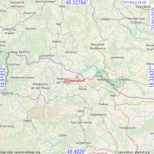
Drosendorf GPS coordinates[2]
48° 52' 3.216" North, 15° 37' 16.464" East
| Map corner | latitude | longitude |
|---|---|---|
| Upper-left | 49.32794°, | 14.91812° |
| Center: | 48.86756°, | 15.62124° |
| Lower-right: | 48.4029°, | 16.32437° |
| Map W x H: | 102.9×102.9 km | = 63.9×63.9mi |
| max Lat: | 48.98333° ⇑0.3% North |
| Drosendorf: | 48.86756° |
| min Lat: | ⇓99.7% South 46.48841° |
| min Long | Drosendorf | max Long |
| 9.57802° | 15.62124° | 17.1° |
| W 69.7%⇐ | ⇒30.3% E |
Elevation
Elevation of Drosendorf is 424 m = 1391 ft, and this is 81.5 m = 267 ft below average elevation for this country.
| Max E: |
2140 m = 7021 ft | 54.5% |
| Avg. | 505.5 m = 1658 ft | |
| Drosendorf | 424 m = 1391 ft | |
Min E: |
118 m = 387 ft | 45.5% |
See also: Austria elevation on elevation.city.
Geographical zone
Drosendorf is located in North temperate zone (between Tropic of Cancer and the Arctic Circle). Distance of this North polar circle is 1967.6 km =1222.6 mi to North.| Distance of | km | miles | from Drosendorf |
|---|---|---|---|
| North Pole | 4573.5 | 2841.8 | to North |
| Arctic Circle | 1967.6 | 1222.6 | to North |
| Tropic Cancer | 2827.6 | 1757 | to South |
| Equator | 5433.6 | 3376.3 | to South |


Nearby cities:
15 places around Drosendorf: (largest is in red/bold)
• Alt-Dietmanns
19.3 km =12 mi,  244°
244°
• Brunn an der Wild
20.6 km =12.8 mi,  201°
201°
• Dobersberg
22.5 km =14 mi,  283°
283°
• Frauenhofen
21.7 km =13.5 mi,  178°
178°
• Geras
8.7 km =5.4 mi,  154°
154°
• Groß-Siegharts
18 km =11.2 mi, 242°
• Göpfritz an der Wild
22.5 km =14 mi,  225°
225°
• Hardegg
16.8 km =10.4 mi,  96°
96°
• Japons
9.2 km =5.7 mi, 204°
• Karlstein
16.3 km =10.1 mi, 276°
• Langau
8 km =5 mi,  119°
119°
• Pernegg
14.9 km =9.3 mi, 181°
• Raabs an der Thaya
9.1 km =5.7 mi,  257°
257°
• Waldkirchen an der Thaya
21.1 km =13.1 mi,  290°
290°
• Weitersfeld
17 km =10.6 mi, 124°
Sources, notices
• [Note1] Compared only with cities in Austria existing in our database
• [Src1] Map data: © OpenStreetMap contributors (CC-BY-SA)
• [Src2] Other city data from geonames.org with taken over terms of usage.
• [Src3] Geographical zone / Annual Mean Temperature by Robert A. Rohde @ Wikipedia
