Ottenschlag geodata
Ottenschlag (Lower Austria) is a seat of a third-order administrative division; located in Austria in Europe/Vienna (GMT+2) time zone. With population of 785 people, there are 1645 cities with bigger population in this country. Compared to other cities in Austria, 91.6% of cities are located further ↓South; 58% of cities are located further ←West and 88.3% of cities have lower elevation than Ottenschlag. Note1
Administrative division(s):
- Level 1: Lower Austria
- Level 2: Politischer Bezirk Zwettl
- Level 3: Ottenschlag


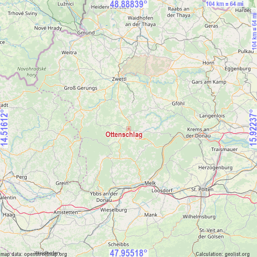
Ottenschlag GPS coordinates[2]
48° 25' 26.148" North, 15° 13' 9.264" East
| Map corner | latitude | longitude |
|---|---|---|
| Upper-left | 48.88839°, | 14.51612° |
| Center: | 48.42393°, | 15.21924° |
| Lower-right: | 47.95518°, | 15.92237° |
| Map W x H: | 103.8×103.8 km | = 64.5×64.5mi |
| max Lat: | 48.98333° ⇑8.4% North |
| Ottenschlag: | 48.42393° |
| min Lat: | ⇓91.6% South 46.48841° |
| min Long | Ottenschlag | max Long |
| 9.57802° | 15.21924° | 17.1° |
| W 58%⇐ | ⇒42% E |
Elevation
Elevation of Ottenschlag is 849 m = 2785 ft, and this is 343.5 m = 1127 ft above average elevation for this country.
| Max E: |
2140 m = 7021 ft | 11.7% |
| Ottenschlag | 849 m 2785 ft | |
| Avg. | 505.5 m = 1658 ft | |
Min E: |
118 m = 387 ft | 88.3% |
See also: Austria elevation on elevation.city.
Geographical zone
Ottenschlag is located in North temperate zone (between Tropic of Cancer and the Arctic Circle). Distance of this North polar circle is 2016.9 km =1253.2 mi to North.| Distance of | km | miles | from Ottenschlag |
|---|---|---|---|
| North Pole | 4622.8 | 2872.5 | to North |
| Arctic Circle | 2016.9 | 1253.2 | to North |
| Tropic Cancer | 2778.3 | 1726.4 | to South |
| Equator | 5384.2 | 3345.6 | to South |


Nearby cities:
15 places around Ottenschlag: (largest is in red/bold)
• Bad Traunstein
7.7 km =4.8 mi,  282°
282°
• Grafenschlag
9.3 km =5.8 mi,  335°
335°
• Gutenbrunn
9.9 km =6.2 mi,  228°
228°
• Kirchschlag
3.4 km =2.1 mi,  175°
175°
• Laimbach am Ostrong
14.1 km =8.8 mi,  212°
212°
• Martinsberg
7.4 km =4.6 mi,  223°
223°
• Mühldorf
10.9 km =6.8 mi,  120°
120°
• Pöggstall
11.9 km =7.4 mi,  185°
185°
• Rappottenstein
15 km =9.3 mi,  316°
316°
• Raxendorf
10.1 km =6.3 mi,  155°
155°
• Sallingberg
4.9 km =3 mi,  12°
12°
• Schönbach
14 km =8.7 mi, 281°
• Waldhausen
11.3 km =7 mi,  16°
16°
• Weinzierl am Walde
15.7 km =9.8 mi,  86°
86°
• Weiten
14.6 km =9.1 mi,  168°
168°
Sources, notices
• [Note1] Compared only with cities in Austria existing in our database
• [Src1] Map data: © OpenStreetMap contributors (CC-BY-SA)
• [Src2] Other city data from geonames.org with taken over terms of usage.
• [Src3] Geographical zone / Annual Mean Temperature by Robert A. Rohde @ Wikipedia
