Rastenfeld geodata
Rastenfeld (Lower Austria) is a seat of a third-order administrative division; located in Austria in Europe/Vienna (GMT+2) time zone. With population of 503 people, there are 2499 cities with bigger population in this country. Compared to other cities in Austria, 96% of cities are located further ↓South; 61% of cities are located further ←West and 68.5% of cities have lower elevation than Rastenfeld. Note1
Administrative division(s):
- Level 1: Lower Austria
- Level 2: Politischer Bezirk Krems
- Level 3: Rastenfeld


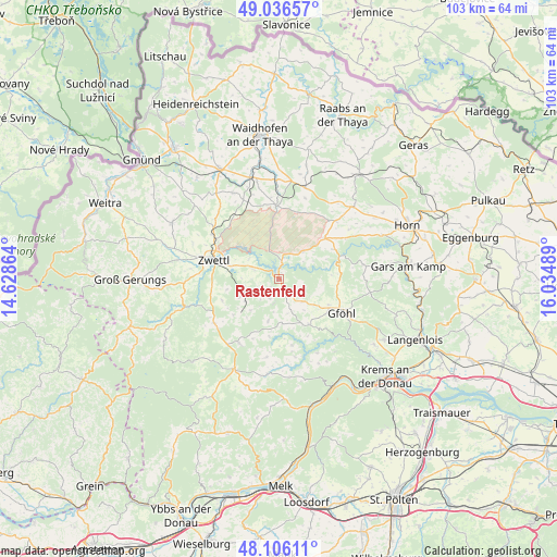
Rastenfeld GPS coordinates[2]
48° 34' 24.528" North, 15° 19' 54.336" East
| Map corner | latitude | longitude |
|---|---|---|
| Upper-left | 49.03657°, | 14.62864° |
| Center: | 48.57348°, | 15.33176° |
| Lower-right: | 48.10611°, | 16.03489° |
| Map W x H: | 103.5×103.5 km | = 64.3×64.3mi |
| max Lat: | 48.98333° ⇑4% North |
| Rastenfeld: | 48.57348° |
| min Lat: | ⇓96% South 46.48841° |
| min Long | Rastenfeld | max Long |
| 9.57802° | 15.33176° | 17.1° |
| W 61%⇐ | ⇒39% E |
Elevation
Elevation of Rastenfeld is 575 m = 1886 ft, and this is 69.5 m = 228 ft above average elevation for this country.
| Max E: |
2140 m = 7021 ft | 31.5% |
| Rastenfeld | 575 m 1886 ft | |
| Avg. | 505.5 m = 1658 ft | |
Min E: |
118 m = 387 ft | 68.5% |
See also: Austria elevation on elevation.city.
Geographical zone
Rastenfeld is located in North temperate zone (between Tropic of Cancer and the Arctic Circle). Distance of this North polar circle is 2000.3 km =1242.9 mi to North.| Distance of | km | miles | from Rastenfeld |
|---|---|---|---|
| North Pole | 4606.2 | 2862.2 | to North |
| Arctic Circle | 2000.3 | 1242.9 | to North |
| Tropic Cancer | 2794.9 | 1736.7 | to South |
| Equator | 5400.9 | 3356 | to South |


Nearby cities:
15 places around Rastenfeld: (largest is in red/bold)
• Allentsteig
13.8 km =8.6 mi,  358°
358°
• Echsenbach
18 km =11.2 mi,  332°
332°
• Gföhl
12.8 km =8 mi,  119°
119°
• Grafenschlag
14.6 km =9.1 mi,  236°
236°
• Göpfritz an der Wild
17.6 km =10.9 mi,  17°
17°
• Jaidhof
12 km =7.5 mi,  111°
111°
• Krumau am Kamp
8.8 km =5.5 mi,  78°
78°
• Rudmanns
9.8 km =6.1 mi,  289°
289°
• Röhrenbach
15 km =9.3 mi,  55°
55°
• Sallingberg
13.9 km =8.6 mi,  211°
211°
• Sankt Leonhard am Hornerwald
15.1 km =9.4 mi, 78°
• Waldhausen
7.7 km =4.8 mi,  221°
221°
• Weinzierl am Walde
17.4 km =10.8 mi,  154°
154°
• Wolfshoferamt
17.5 km =10.9 mi, 80°
• Zwettl Stadt
12.7 km =7.9 mi, 287°
Sources, notices
• [Note1] Compared only with cities in Austria existing in our database
• [Src1] Map data: © OpenStreetMap contributors (CC-BY-SA)
• [Src2] Other city data from geonames.org with taken over terms of usage.
• [Src3] Geographical zone / Annual Mean Temperature by Robert A. Rohde @ Wikipedia
