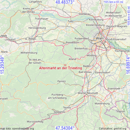
Altenmarkt an der Triesting geodata
Altenmarkt an der Triesting (Lower Austria) is a seat of a third-order administrative division; located in Austria in Europe/Vienna (GMT+2) time zone. With population of 559 people, there are 2280 cities with bigger population in this country. Compared to other cities in Austria, 67.1% of cities are located further ↓South; 80.2% of cities are located further ←West and 58.8% of cities have higher elevation than Altenmarkt an der Triesting. Note1
Administrative division(s):
- Level 1: Lower Austria
- Level 2: Politischer Bezirk Baden
- Level 3: Altenmarkt an der Triesting
Current local time in Altenmarkt an der Triesting:
11:53 PM, FridayDifference from your time zone: hours


Altenmarkt an der Triesting GPS coordinates[2]
48° 0' 55.908" North, 15° 59' 47.796" East
| Map corner | latitude | longitude |
|---|---|---|
| Upper-left | 48.48373°, | 15.29349° |
| Center: | 48.01553°, | 15.99661° |
| Lower-right: | 47.54304°, | 16.69974° |
| Map W x H: | 104.6×104.6 km | = 65×65mi |
| max Lat: | 48.98333° ⇑32.9% North |
| Altenmarkt an der Triesting: | 48.01553° |
| min Lat: | ⇓67.1% South 46.48841° |
| min Long | Altenmarkt an d | max Long |
| 9.57802° | 15.99661° | 17.1° |
| W 80.2%⇐ | ⇒19.8% E |
Elevation
Elevation of Altenmarkt an der Triesting is 393 m = 1289 ft, and this is 112.5 m = 369 ft below average elevation for this country.
| Max E: |
2140 m = 7021 ft | 58.8% |
| Avg. | 505.5 m = 1658 ft | |
| Altenmarkt an der Triesting | 393 m = 1289 ft | |
Min E: |
118 m = 387 ft | 41.2% |
See also: Austria elevation on elevation.city.
Geographical zone
Altenmarkt an der Triesting is located in North temperate zone (between Tropic of Cancer and the Arctic Circle). Distance of this North polar circle is 2062.3 km =1281.5 mi to North.| Distance of | km | miles | from Altenmarkt an der Triesting |
|---|---|---|---|
| North Pole | 4668.2 | 2900.7 | to North |
| Arctic Circle | 2062.3 | 1281.5 | to North |
| Tropic Cancer | 2732.9 | 1698.1 | to South |
| Equator | 5338.8 | 3317.4 | to South |


Nearby cities:
15 places around Altenmarkt an der Triesting: (largest is in red/bold)
• Alland
7.8 km =4.8 mi,  52°
52°
• Berndorf
11.5 km =7.1 mi,  132°
132°
• Furth an der Triesting
5 km =3.1 mi,  200°
200°
• Grub
11.1 km =6.9 mi, 50°
• Heiligenkreuz
10.5 km =6.5 mi,  64°
64°
• Kaumberg
7.4 km =4.6 mi,  277°
277°
• Klausen-Leopoldsdorf
8.2 km =5.1 mi,  10°
10°
• Muggendorf
12.5 km =7.8 mi, 201°
• Neuhaus
4.3 km =2.7 mi,  121°
121°
• Pernitz
13.4 km =8.3 mi,  191°
191°
• Pottenstein
9.7 km =6 mi, 131°
• Siegenfeld
13.5 km =8.4 mi,  80°
80°
• Sittendorf
14 km =8.7 mi, 61°
• Thenneberg
2.3 km =1.4 mi,  274°
274°
• Weissenbach an der Triesting
4.9 km =3 mi,  139°
139°
Sources, notices
• [Note1] Compared only with cities in Austria existing in our database
• [Src1] Map data: © OpenStreetMap contributors (CC-BY-SA)
• [Src2] Other city data from geonames.org with taken over terms of usage.
• [Src3] Geographical zone / Annual Mean Temperature by Robert A. Rohde @ Wikipedia
