Münzbach geodata
Münzbach (Upper Austria) is a populated place; located in Austria in Europe/Vienna (GMT+2) time zone. With population of 1,041 people, there are 1229 cities with bigger population in this country. Compared to other cities in Austria, 83.9% of cities are located further ↓South; 50.2% of cities are located further →East and 55.5% of cities have higher elevation than Münzbach. Note1
Administrative division(s):
- Level 1: Upper Austria
- Level 2: Politischer Bezirk Perg
- Level 3: Münzbach


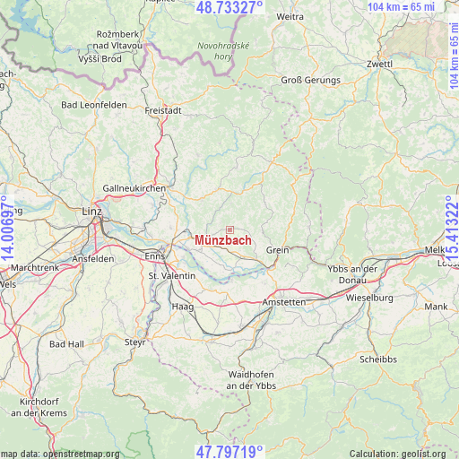
Münzbach GPS coordinates[2]
48° 16' 2.532" North, 14° 42' 36.324" East
| Map corner | latitude | longitude |
|---|---|---|
| Upper-left | 48.73327°, | 14.00697° |
| Center: | 48.26737°, | 14.71009° |
| Lower-right: | 47.79719°, | 15.41322° |
| Map W x H: | 104.1×104.1 km | = 64.7×64.7mi |
| max Lat: | 48.98333° ⇑16.1% North |
| Münzbach: | 48.26737° |
| min Lat: | ⇓83.9% South 46.48841° |
| min Long | Münzbach | max Long |
| 9.57802° | 14.71009° | 17.1° |
| W 49.8%⇐ | ⇒50.2% E |
Elevation
Elevation of Münzbach is 415 m = 1362 ft, and this is 90.5 m = 297 ft below average elevation for this country.
| Max E: |
2140 m = 7021 ft | 55.5% |
| Avg. | 505.5 m = 1658 ft | |
| Münzbach | 415 m = 1362 ft | |
Min E: |
118 m = 387 ft | 44.5% |
See also: Austria elevation on elevation.city.
Geographical zone
Münzbach is located in North temperate zone (between Tropic of Cancer and the Arctic Circle). Distance of this North polar circle is 2034.3 km =1264.1 mi to North.| Distance of | km | miles | from Münzbach |
|---|---|---|---|
| North Pole | 4640.2 | 2883.3 | to North |
| Arctic Circle | 2034.3 | 1264.1 | to North |
| Tropic Cancer | 2760.9 | 1715.5 | to South |
| Equator | 5366.8 | 3334.8 | to South |


Nearby cities:
15 places around Münzbach: (largest is in red/bold)
• Allerheiligen im Mühlkreis
5.9 km =3.7 mi,  311°
311°
• Arbing
4.3 km =2.7 mi,  187°
187°
• Au an der Donau
10.3 km =6.4 mi,  245°
245°
• Bad Kreuzen
7.1 km =4.4 mi,  90°
90°
• Bad Zell
9.6 km =6 mi,  341°
341°
• Baumgartenberg
7 km =4.3 mi,  159°
159°
• Mitterkirchen im Machland
8.9 km =5.5 mi, 186°
• Naarn im Machlande
8.9 km =5.5 mi,  238°
238°
• Pabneukirchen
10.1 km =6.3 mi,  51°
51°
• Perg
6 km =3.7 mi, 251°
• Pierbach
9.6 km =6 mi,  20°
20°
• Saxen
8.9 km =5.5 mi,  137°
137°
• Schwertberg
9.3 km =5.8 mi,  274°
274°
• Tragwein
9.8 km =6.1 mi,  318°
318°
• Windhaag bei Perg
3 km =1.9 mi, 313°
Sources, notices
• [Note1] Compared only with cities in Austria existing in our database
• [Src1] Map data: © OpenStreetMap contributors (CC-BY-SA)
• [Src2] Other city data from geonames.org with taken over terms of usage.
• [Src3] Geographical zone / Annual Mean Temperature by Robert A. Rohde @ Wikipedia
