Aggsbach geodata
Aggsbach (Lower Austria) is a seat of a third-order administrative division; located in Austria in Europe/Vienna (GMT+2) time zone. With population of 391 people, there are 2627 cities with bigger population in this country. Compared to other cities in Austria, 85.6% of cities are located further ↓South; 62.9% of cities are located further ←West and 90.7% of cities have higher elevation than Aggsbach. Note1
Administrative division(s):
- Level 1: Lower Austria
- Level 2: Politischer Bezirk Krems
- Level 3: Aggsbach


Aggsbach GPS coordinates[2]
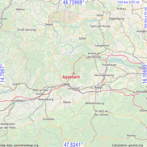
48° 17' 38.544" North, 15° 24' 13.752" East
| Map corner | latitude | longitude |
|---|---|---|
| Upper-left | 48.75969°, | 14.7007° |
| Center: | 48.29404°, | 15.40382° |
| Lower-right: | 47.8241°, | 16.10695° |
| Map W x H: | 104×104 km | = 64.6×64.6mi |
| max Lat: | 48.98333° ⇑14.4% North |
| Aggsbach: | 48.29404° |
| min Lat: | ⇓85.6% South 46.48841° |
| min Long | Aggsbach | max Long |
| 9.57802° | 15.40382° | 17.1° |
| W 62.9%⇐ | ⇒37.1% E |
Elevation
Elevation of Aggsbach is 209 m = 686 ft, and this is 296.5 m = 973 ft below average elevation for this country.
| Max E: |
2140 m = 7021 ft | 90.7% |
| Avg. | 505.5 m = 1658 ft | |
| Aggsbach | 209 m = 686 ft | |
Min E: |
118 m = 387 ft | 9.3% |
See also: Austria elevation on elevation.city.
Geographical zone
Aggsbach is located in North temperate zone (between Tropic of Cancer and the Arctic Circle). Distance of this North polar circle is 2031.4 km =1262.3 mi to North.| Distance of | km | miles | from Aggsbach |
|---|---|---|---|
| North Pole | 4637.3 | 2881.5 | to North |
| Arctic Circle | 2031.4 | 1262.3 | to North |
| Tropic Cancer | 2763.9 | 1717.4 | to South |
| Equator | 5369.8 | 3336.6 | to South |


Nearby cities:
15 places around Aggsbach: (largest is in red/bold)
• Emmersdorf an der Donau
7.7 km =4.8 mi,  220°
220°
• Gansbach
5.2 km =3.2 mi,  75°
75°
• Gerolding
5 km =3.1 mi,  169°
169°
• Groß Sierning
11.9 km =7.4 mi,  160°
160°
• Hafnerbach
10.4 km =6.5 mi,  145°
145°
• Haunoldstein
11 km =6.8 mi, 161°
• Leiben
10.9 km =6.8 mi,  240°
240°
• Loosdorf
10.5 km =6.5 mi,  181°
181°
• Maria Laach am Jauerling
4.5 km =2.8 mi,  284°
284°
• Mauer bei Melk
7.5 km =4.7 mi, 173°
• Melk
9.1 km =5.7 mi, 215°
• Mühldorf
9.9 km =6.2 mi,  334°
334°
• Raxendorf
10.8 km =6.7 mi,  299°
299°
• Spitz
8 km =5 mi,  5°
5°
• Weiten
10.6 km =6.6 mi,  270°
270°
Sources, notices
• [Note1] Compared only with cities in Austria existing in our database
• [Src1] Map data: © OpenStreetMap contributors (CC-BY-SA)
• [Src2] Other city data from geonames.org with taken over terms of usage.
• [Src3] Geographical zone / Annual Mean Temperature by Robert A. Rohde @ Wikipedia
