Wilcannia geodata
Wilcannia (New South Wales) is a populated place; located in Australia in Australia/Sydney (GMT+11) time zone. With population of 782 people, there are 4180 cities with bigger population in this country. Compared to other cities in Australia, 69.5% of cities are located further ↓South; 73.8% of cities are located further →East and 64.6% of cities have lower elevation than Wilcannia. Note1


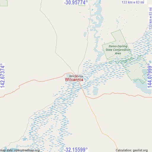
Wilcannia GPS coordinates[2]
31° 33' 31.644" South, 143° 22' 36.696" East
| Map corner | latitude | longitude |
|---|---|---|
| Upper-left | -30.95774°, | 142.67374° |
| Center: | -31.55879°, | 143.37686° |
| Lower-right: | -32.15599°, | 144.07999° |
| Map W x H: | 133.2×133.2 km | = 82.8×82.8mi |
| max Lat: | -10.58257° ⇑30.5% North |
| Wilcannia: | -31.55879° |
| min Lat: | ⇓69.5% South -43.31423° |
| min Long | Wilcannia | max Long |
| 113.53327° | 143.37686° | 153.61246° |
| W 26.2%⇐ | ⇒73.8% E |
Elevation
Elevation of Wilcannia is 79 m = 259 ft, and this is 43 m = 141 ft below average elevation for this country.
| Max E: |
1715 m = 5627 ft | 35.4% |
| Avg. | 122 m = 400 ft | |
| Wilcannia | 79 m = 259 ft | |
Min E: |
-2 m = -7 ft | 64.6% |
See also: Australia elevation on elevation.city.
Geographical zone
Wilcannia is located in South temperate zone (between Tropic of Capricorn and the Antarctic Circle). Distance of this Southern Tropic circle is 903.1 km =561.2 mi to North.| Distance of | km | miles | from Wilcannia |
|---|---|---|---|
| Equator | 3509 | 2180.4 | to North |
| Tropic Capricorn | 903.1 | 561.2 | to North |
| Antarctic Circle | 3892.2 | 2418.5 | to South |
| South Pole | 6498.1 | 4037.7 | to South |


Nearby cities:
15 places around Wilcannia: (largest is in red/bold)
• Birdwoodton
318.1 km =197.7 mi,  202°
202°
• Bourke
293.9 km =182.6 mi,  56°
56°
• Broken Hill
187.6 km =116.6 mi,  256°
256°
• Buronga
311.4 km =193.5 mi, 201°
• Cobar
233 km =144.8 mi,  88°
88°
• Coomealla
306.8 km =190.6 mi, 203°
• Dareton
308.4 km =191.6 mi, 203°
• Gol Gol
310.1 km =192.7 mi, 200°
• Hillston
294.4 km =182.9 mi,  136°
136°
• Menindee
129.5 km =80.5 mi,  224°
224°
• Merbein
314.9 km =195.7 mi, 202°
• Mildura
313.3 km =194.7 mi, 201°
• Nichols Point
314.3 km =195.3 mi, 200°
• North Bourke
297.3 km =184.7 mi, 55°
• Wentworth
314.6 km =195.5 mi,  205°
205°
Sources, notices
• [Note1] Compared only with cities in Australia existing in our database
• [Src1] Map data: © OpenStreetMap contributors (CC-BY-SA)
• [Src2] Other city data from geonames.org with taken over terms of usage.
• [Src3] Geographical zone / Annual Mean Temperature by Robert A. Rohde @ Wikipedia
