North Bourke geodata
North Bourke (New South Wales) is a populated place; located in Australia in Australia/Sydney (GMT+11) time zone. With population of 544 people, there are 4725 cities with bigger population in this country. Compared to other cities in Australia, 72.3% of cities are located further ↓South; 57.3% of cities are located further →East and 71.7% of cities have lower elevation than North Bourke. Note1


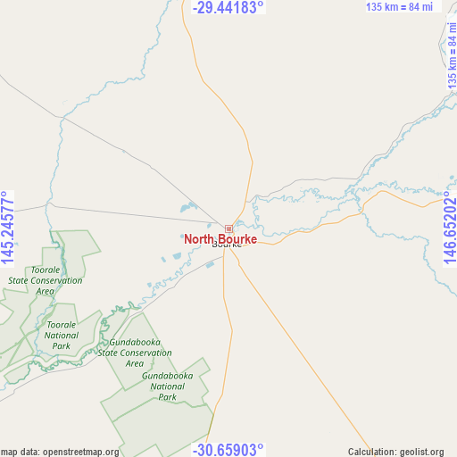
North Bourke GPS coordinates[2]
30° 3' 8.28" South, 145° 56' 56.004" East
| Map corner | latitude | longitude |
|---|---|---|
| Upper-left | -29.44183°, | 145.24577° |
| Center: | -30.0523°, | 145.94889° |
| Lower-right: | -30.65903°, | 146.65202° |
| Map W x H: | 135.3×135.3 km | = 84.1×84.1mi |
| max Lat: | -10.58257° ⇑27.7% North |
| North Bourke: | -30.0523° |
| min Lat: | ⇓72.3% South -43.31423° |
| min Long | North Bourke | max Long |
| 113.53327° | 145.94889° | 153.61246° |
| W 42.7%⇐ | ⇒57.3% E |
Elevation
Elevation of North Bourke is 111 m = 364 ft, and this is 11 m = 36 ft below average elevation for this country.
| Max E: |
1715 m = 5627 ft | 28.3% |
| Avg. | 122 m = 400 ft | |
| North Bourke | 111 m = 364 ft | |
Min E: |
-2 m = -7 ft | 71.7% |
See also: Australia elevation on elevation.city.
Geographical zone
North Bourke is located in South temperate zone (between Tropic of Capricorn and the Antarctic Circle). Distance of this Southern Tropic circle is 735.6 km =457.1 mi to North.| Distance of | km | miles | from North Bourke |
|---|---|---|---|
| Equator | 3341.5 | 2076.3 | to North |
| Tropic Capricorn | 735.6 | 457.1 | to North |
| Antarctic Circle | 4059.7 | 2522.6 | to South |
| South Pole | 6665.6 | 4141.8 | to South |


Nearby cities:
15 places around North Bourke: (largest is in red/bold)
• Baradine
315.1 km =195.8 mi,  108°
108°
• Bourke
4.4 km =2.7 mi,  195°
195°
• Brewarrina
88.3 km =54.9 mi,  83°
83°
• Cobar
161 km =100 mi,  183°
183°
• Collarenebri
259.7 km =161.4 mi, 77°
• Coonamble
254.3 km =158 mi, 113°
• Cunnamulla
222.2 km =138.1 mi,  353°
353°
• Dirranbandi
274.4 km =170.5 mi,  53°
53°
• Gulargambone
280.3 km =174.2 mi,  120°
120°
• Lightning Ridge
207.9 km =129.2 mi,  70°
70°
• Nyngan
205.9 km =127.9 mi,  144°
144°
• Trangie
293.2 km =182.2 mi, 138°
• Walgett
208.6 km =129.6 mi,  89°
89°
• Warren
256.9 km =159.6 mi, 135°
• Wilcannia
297.3 km =184.7 mi,  235°
235°
Sources, notices
• [Note1] Compared only with cities in Australia existing in our database
• [Src1] Map data: © OpenStreetMap contributors (CC-BY-SA)
• [Src2] Other city data from geonames.org with taken over terms of usage.
• [Src3] Geographical zone / Annual Mean Temperature by Robert A. Rohde @ Wikipedia
