Warwick geodata
Warwick (Queensland) is a populated place; located in Australia in Australia/Brisbane (GMT+10) time zone. With population of 12,208 people, there are 395 cities with bigger population in this country. Compared to other cities in Australia, 75.1% of cities are located further ↓South; 82.8% of cities are located further ←West and 92.7% of cities have lower elevation than Warwick. Note1


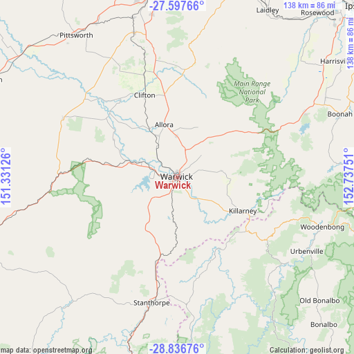
Warwick GPS coordinates[2]
28° 13' 8.436" South, 152° 2' 3.768" East
| Map corner | latitude | longitude |
|---|---|---|
| Upper-left | -27.59766°, | 151.33126° |
| Center: | -28.21901°, | 152.03438° |
| Lower-right: | -28.83676°, | 152.73751° |
| Map W x H: | 137.8×137.8 km | = 85.6×85.6mi |
| max Lat: | -10.58257° ⇑24.9% North |
| Warwick: | -28.21901° |
| min Lat: | ⇓75.1% South -43.31423° |
| min Long | Warwick | max Long |
| 113.53327° | 152.03438° | 153.61246° |
| W 82.8%⇐ | ⇒17.2% E |
Elevation
Elevation of Warwick is 462 m = 1516 ft, and this is 340 m = 1115 ft above average elevation for this country.
| Max E: |
1715 m = 5627 ft | 7.3% |
| Warwick | 462 m 1516 ft | |
| Avg. | 122 m = 400 ft | |
Min E: |
-2 m = -7 ft | 92.7% |
See also: Australia elevation on elevation.city.
Geographical zone
Warwick is located in South temperate zone (between Tropic of Capricorn and the Antarctic Circle). Distance of this Southern Tropic circle is 531.7 km =330.4 mi to North.| Distance of | km | miles | from Warwick |
|---|---|---|---|
| Equator | 3137.7 | 1949.7 | to North |
| Tropic Capricorn | 531.7 | 330.4 | to North |
| Antarctic Circle | 4263.5 | 2649.2 | to South |
| South Pole | 6869.4 | 4268.4 | to South |


Nearby cities:
15 places around Warwick: (largest is in red/bold)
• Allora
21.1 km =13.1 mi,  345°
345°
• Aratula
55.5 km =34.5 mi,  61°
61°
• Cambooya
58.6 km =36.4 mi,  343°
343°
• Clifton
34.1 km =21.2 mi, 338°
• Dugandan
66.2 km =41.1 mi,  70°
70°
• Greenmount
49.9 km =31 mi, 344°
• Hodgson Vale
62.4 km =38.8 mi, 350°
• Kalbar
65.5 km =40.7 mi, 61°
• Killarney
28.4 km =17.6 mi,  116°
116°
• Nobby
41.8 km =26 mi, 341°
• Preston
62.3 km =38.7 mi,  355°
355°
• Rosenthal Heights
3.1 km =1.9 mi,  221°
221°
• Stanthorpe
49.4 km =30.7 mi,  191°
191°
• Top Camp
65.5 km =40.7 mi, 351°
• Wyreema
65 km =40.4 mi, 344°
Sources, notices
• [Note1] Compared only with cities in Australia existing in our database
• [Src1] Map data: © OpenStreetMap contributors (CC-BY-SA)
• [Src2] Other city data from geonames.org with taken over terms of usage.
• [Src3] Geographical zone / Annual Mean Temperature by Robert A. Rohde @ Wikipedia
