Allora geodata
Allora (Queensland) is a populated place; located in Australia in Australia/Brisbane (GMT+10) time zone. With population of 1,197 people, there are 3587 cities with bigger population in this country. Compared to other cities in Australia, 75.9% of cities are located further ↓South; 82.6% of cities are located further ←West and 93% of cities have lower elevation than Allora. Note1


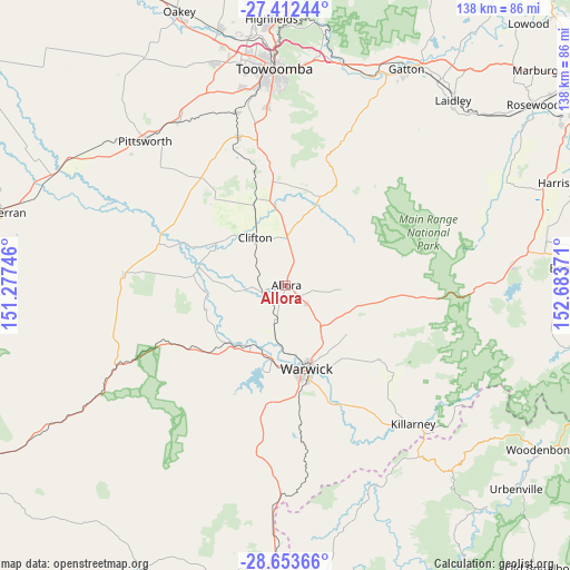
Allora GPS coordinates[2]
28° 2' 5.424" South, 151° 58' 50.088" East
| Map corner | latitude | longitude |
|---|---|---|
| Upper-left | -27.41244°, | 151.27746° |
| Center: | -28.03484°, | 151.98058° |
| Lower-right: | -28.65366°, | 152.68371° |
| Map W x H: | 138×138 km | = 85.7×85.7mi |
| max Lat: | -10.58257° ⇑24.1% North |
| Allora: | -28.03484° |
| min Lat: | ⇓75.9% South -43.31423° |
| min Long | Allora | max Long |
| 113.53327° | 151.98058° | 153.61246° |
| W 82.6%⇐ | ⇒17.4% E |
Elevation
Elevation of Allora is 470 m = 1542 ft, and this is 348 m = 1142 ft above average elevation for this country.
| Max E: |
1715 m = 5627 ft | 7% |
| Allora | 470 m 1542 ft | |
| Avg. | 122 m = 400 ft | |
Min E: |
-2 m = -7 ft | 93% |
See also: Australia elevation on elevation.city.
Geographical zone
Allora is located in South temperate zone (between Tropic of Capricorn and the Antarctic Circle). Distance of this Southern Tropic circle is 511.3 km =317.7 mi to North.| Distance of | km | miles | from Allora |
|---|---|---|---|
| Equator | 3117.2 | 1936.9 | to North |
| Tropic Capricorn | 511.3 | 317.7 | to North |
| Antarctic Circle | 4284 | 2662 | to South |
| South Pole | 6889.9 | 4281.2 | to South |


Nearby cities:
15 places around Allora: (largest is in red/bold)
• Cambooya
37.5 km =23.3 mi,  341°
341°
• Clifton
13.4 km =8.3 mi,  327°
327°
• Greenmount
28.8 km =17.9 mi, 344°
• Hodgson Vale
41.4 km =25.7 mi,  353°
353°
• Kearneys Spring
48 km =29.8 mi,  355°
355°
• Killarney
45.2 km =28.1 mi,  137°
137°
• Middle Ridge
47.6 km =29.6 mi, 358°
• Nobby
20.8 km =12.9 mi, 337°
• Preston
41.6 km =25.8 mi,  0°
0°
• Rosenthal Heights
23.1 km =14.4 mi,  172°
172°
• Southbrook
46.9 km =29.1 mi, 326°
• Top Camp
44.6 km =27.7 mi, 354°
• Warwick
21.1 km =13.1 mi, 165°
• Westbrook
47.8 km =29.7 mi, 346°
• Wyreema
43.9 km =27.3 mi, 343°
Sources, notices
• [Note1] Compared only with cities in Australia existing in our database
• [Src1] Map data: © OpenStreetMap contributors (CC-BY-SA)
• [Src2] Other city data from geonames.org with taken over terms of usage.
• [Src3] Geographical zone / Annual Mean Temperature by Robert A. Rohde @ Wikipedia
