Ventnor geodata
Ventnor (Victoria) is a populated place; located in Australia in Australia/Melbourne (GMT+11) time zone. With population of 798 people, there are 4151 cities with bigger population in this country. Compared to other cities in Australia, 95.8% of cities are located further ↑North; 62.7% of cities are located further →East and 86.8% of cities have higher elevation than Ventnor. Note1


Ventnor GPS coordinates[2]
38° 27' 45.828" South, 145° 11' 41.892" East
| Map corner | latitude | longitude |
|---|---|---|
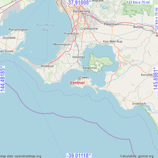
| Upper-left | -37.91008°, | 144.49185° |
| Center: | -38.46273°, | 145.19497° |
| Lower-right: | -39.01118°, | 145.8981° |
| Map W x H: | 122.4×122.4 km | = 76.1×76.1mi |
| max Lat: | -10.58257° ⇑95.8% North |
| Ventnor: | -38.46273° |
| min Lat: | ⇓4.2% South -43.31423° |
| min Long | Ventnor | max Long |
| 113.53327° | 145.19497° | 153.61246° |
| W 37.3%⇐ | ⇒62.7% E |
Elevation
Elevation of Ventnor is 11 m = 36 ft, and this is 111 m = 364 ft below average elevation for this country.
| Max E: |
1715 m = 5627 ft | 86.8% |
| Avg. | 122 m = 400 ft | |
| Ventnor | 11 m = 36 ft | |
Min E: |
-2 m = -7 ft | 13.2% |
See also: Australia elevation on elevation.city.
Geographical zone
Ventnor is located in South temperate zone (between Tropic of Capricorn and the Antarctic Circle). Distance of this Southern Tropic circle is 1670.7 km =1038.1 mi to North.| Distance of | km | miles | from Ventnor |
|---|---|---|---|
| Equator | 4276.7 | 2657.4 | to North |
| Tropic Capricorn | 1670.7 | 1038.1 | to North |
| Antarctic Circle | 3124.5 | 1941.5 | to South |
| South Pole | 5730.4 | 3560.7 | to South |


Nearby cities:
15 places around Ventnor: (largest is in red/bold)
• Balnarring
12 km =7.5 mi,  333°
333°
• Bittern
14.6 km =9.1 mi,  350°
350°
• Cape Woolamai
15.7 km =9.8 mi,  124°
124°
• Cowes
4 km =2.5 mi,  73°
73°
• Crib Point
12.5 km =7.8 mi,  2°
2°
• Flinders
15.1 km =9.4 mi,  265°
265°
• Hastings
18.1 km =11.2 mi,  356°
356°
• Hmas Cerberus
10.9 km =6.8 mi, 2°
• Phillip Island
3.9 km =2.4 mi,  126°
126°
• Red Hill
20 km =12.4 mi,  308°
308°
• Red Hill South
16.6 km =10.3 mi,  302°
302°
• Rhyll
9.1 km =5.7 mi,  91°
91°
• San Remo
17.2 km =10.7 mi,  113°
113°
• Shoreham
13.5 km =8.4 mi,  287°
287°
• Somers
9.6 km =6 mi,  340°
340°
Sources, notices
• [Note1] Compared only with cities in Australia existing in our database
• [Src1] Map data: © OpenStreetMap contributors (CC-BY-SA)
• [Src2] Other city data from geonames.org with taken over terms of usage.
• [Src3] Geographical zone / Annual Mean Temperature by Robert A. Rohde @ Wikipedia
