Flinders geodata
Flinders (Victoria) is a populated place; located in Australia in Australia/Melbourne (GMT+11) time zone. With population of 830 people, there are 4097 cities with bigger population in this country. Compared to other cities in Australia, 95.8% of cities are located further ↑North; 65.9% of cities are located further →East and 51.1% of cities have higher elevation than Flinders. Note1


Flinders GPS coordinates[2]
38° 28' 26.112" South, 145° 1' 19.74" East
| Map corner | latitude | longitude |
|---|---|---|
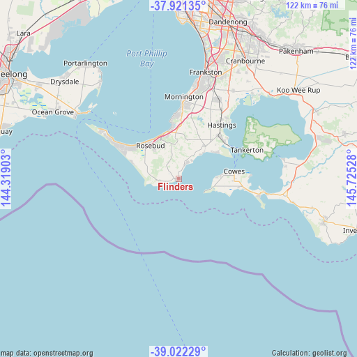
| Upper-left | -37.92135°, | 144.31903° |
| Center: | -38.47392°, | 145.02215° |
| Lower-right: | -39.02229°, | 145.72528° |
| Map W x H: | 122.4×122.4 km | = 76.1×76.1mi |
| max Lat: | -10.58257° ⇑95.8% North |
| Flinders: | -38.47392° |
| min Lat: | ⇓4.2% South -43.31423° |
| min Long | Flinders | max Long |
| 113.53327° | 145.02215° | 153.61246° |
| W 34.1%⇐ | ⇒65.9% E |
Elevation
Elevation of Flinders is 44 m = 144 ft, and this is 78 m = 256 ft below average elevation for this country.
| Max E: |
1715 m = 5627 ft | 51.1% |
| Avg. | 122 m = 400 ft | |
| Flinders | 44 m = 144 ft | |
Min E: |
-2 m = -7 ft | 48.9% |
See also: Australia elevation on elevation.city.
Geographical zone
Flinders is located in South temperate zone (between Tropic of Capricorn and the Antarctic Circle). Distance of this Southern Tropic circle is 1672 km =1038.9 mi to North.| Distance of | km | miles | from Flinders |
|---|---|---|---|
| Equator | 4277.9 | 2658.2 | to North |
| Tropic Capricorn | 1672 | 1038.9 | to North |
| Antarctic Circle | 3123.3 | 1940.7 | to South |
| South Pole | 5729.2 | 3560 | to South |


Nearby cities:
15 places around Flinders: (largest is in red/bold)
• Balnarring
15.4 km =9.6 mi,  39°
39°
• Dromana
16.4 km =10.2 mi,  342°
342°
• Fingal
16.4 km =10.2 mi,  293°
293°
• McCrae
16.1 km =10 mi,  329°
329°
• Phillip Island
18.2 km =11.3 mi,  93°
93°
• Red Hill
13.8 km =8.6 mi,  358°
358°
• Red Hill South
10.1 km =6.3 mi,  5°
5°
• Rosebud
16.6 km =10.3 mi,  322°
322°
• Rosebud West
17.5 km =10.9 mi,  314°
314°
• Safety Beach
17.7 km =11 mi,  353°
353°
• Saint Andrews Beach
18.5 km =11.5 mi, 291°
• Shoreham
5.7 km =3.5 mi,  22°
22°
• Somers
15.7 km =9.8 mi,  49°
49°
• Tootgarook
18.4 km =11.4 mi, 305°
• Ventnor
15.1 km =9.4 mi, 85°
Sources, notices
• [Note1] Compared only with cities in Australia existing in our database
• [Src1] Map data: © OpenStreetMap contributors (CC-BY-SA)
• [Src2] Other city data from geonames.org with taken over terms of usage.
• [Src3] Geographical zone / Annual Mean Temperature by Robert A. Rohde @ Wikipedia
