Singleton geodata
Singleton (New South Wales) is a populated place; located in Australia in Australia/Sydney (GMT+11) time zone. With population of 5,076 people, there are 1454 cities with bigger population in this country. Compared to other cities in Australia, 61.1% of cities are located further ↓South; 72.2% of cities are located further ←West and 50.4% of cities have higher elevation than Singleton. Note1


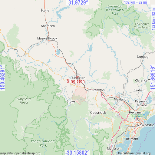
Singleton GPS coordinates[2]
32° 34' 2.712" South, 151° 9' 57.708" East
| Map corner | latitude | longitude |
|---|---|---|
| Upper-left | -31.9729°, | 150.46291° |
| Center: | -32.56742°, | 151.16603° |
| Lower-right: | -33.15802°, | 151.86916° |
| Map W x H: | 131.8×131.8 km | = 81.9×81.9mi |
| max Lat: | -10.58257° ⇑38.9% North |
| Singleton: | -32.56742° |
| min Lat: | ⇓61.1% South -43.31423° |
| min Long | Singleton | max Long |
| 113.53327° | 151.16603° | 153.61246° |
| W 72.2%⇐ | ⇒27.8% E |
Elevation
Elevation of Singleton is 45 m = 148 ft, and this is 77 m = 253 ft below average elevation for this country.
| Max E: |
1715 m = 5627 ft | 50.4% |
| Avg. | 122 m = 400 ft | |
| Singleton | 45 m = 148 ft | |
Min E: |
-2 m = -7 ft | 49.6% |
See also: Australia elevation on elevation.city.
Geographical zone
Singleton is located in South temperate zone (between Tropic of Capricorn and the Antarctic Circle). Distance of this Southern Tropic circle is 1015.2 km =630.8 mi to North.| Distance of | km | miles | from Singleton |
|---|---|---|---|
| Equator | 3621.2 | 2250.1 | to North |
| Tropic Capricorn | 1015.2 | 630.8 | to North |
| Antarctic Circle | 3780 | 2348.8 | to South |
| South Pole | 6385.9 | 3968 | to South |


Nearby cities:
15 places around Singleton: (largest is in red/bold)
• Bellbird Heights
35 km =21.7 mi,  154°
154°
• Branxton
19.9 km =12.4 mi,  119°
119°
• Broke
21.2 km =13.2 mi,  195°
195°
• Cessnock
34.4 km =21.4 mi, 148°
• East Branxton
21 km =13 mi, 117°
• Greta
24.2 km =15 mi, 120°
• Hunterview
2.9 km =1.8 mi,  21°
21°
• Lochinvar
30.8 km =19.1 mi, 118°
• Lovedale
29.3 km =18.2 mi,  140°
140°
• North Rothbury
21.8 km =13.5 mi,  130°
130°
• Nulkaba
31.9 km =19.8 mi, 147°
• Pokolbin
28.1 km =17.5 mi,  156°
156°
• Singleton Heights
2.9 km =1.8 mi,  350°
350°
• Wattle Ponds
5.8 km =3.6 mi,  26°
26°
• Windella
33.1 km =20.6 mi, 117°
Sources, notices
• [Note1] Compared only with cities in Australia existing in our database
• [Src1] Map data: © OpenStreetMap contributors (CC-BY-SA)
• [Src2] Other city data from geonames.org with taken over terms of usage.
• [Src3] Geographical zone / Annual Mean Temperature by Robert A. Rohde @ Wikipedia
