Wattle Ponds geodata
Wattle Ponds (New South Wales) is a populated place; located in Australia in Australia/Sydney (GMT+11) time zone. With population of 1,087 people, there are 3715 cities with bigger population in this country. Compared to other cities in Australia, 61.5% of cities are located further ↓South; 72.9% of cities are located further ←West and 72% of cities have lower elevation than Wattle Ponds. Note1


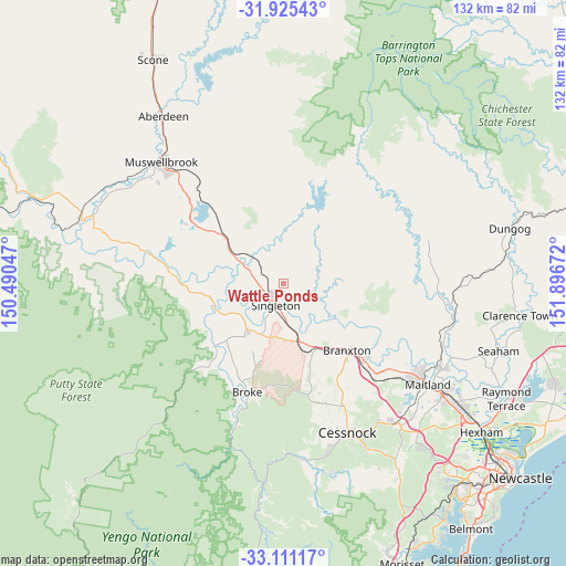
Wattle Ponds GPS coordinates[2]
32° 31' 12.936" South, 151° 11' 36.924" East
| Map corner | latitude | longitude |
|---|---|---|
| Upper-left | -31.92543°, | 150.49047° |
| Center: | -32.52026°, | 151.19359° |
| Lower-right: | -33.11117°, | 151.89672° |
| Map W x H: | 131.8×131.8 km | = 81.9×81.9mi |
| max Lat: | -10.58257° ⇑38.5% North |
| Wattle Ponds: | -32.52026° |
| min Lat: | ⇓61.5% South -43.31423° |
| min Long | Wattle Ponds | max Long |
| 113.53327° | 151.19359° | 153.61246° |
| W 72.9%⇐ | ⇒27.1% E |
Elevation
Elevation of Wattle Ponds is 112 m = 367 ft, and this is 10 m = 33 ft below average elevation for this country.
| Max E: |
1715 m = 5627 ft | 28% |
| Avg. | 122 m = 400 ft | |
| Wattle Ponds | 112 m = 367 ft | |
Min E: |
-2 m = -7 ft | 72% |
See also: Australia elevation on elevation.city.
Geographical zone
Wattle Ponds is located in South temperate zone (between Tropic of Capricorn and the Antarctic Circle). Distance of this Southern Tropic circle is 1010 km =627.6 mi to North.| Distance of | km | miles | from Wattle Ponds |
|---|---|---|---|
| Equator | 3615.9 | 2246.8 | to North |
| Tropic Capricorn | 1010 | 627.6 | to North |
| Antarctic Circle | 3785.3 | 2352.1 | to South |
| South Pole | 6391.1 | 3971.2 | to South |


Nearby cities:
15 places around Wattle Ponds: (largest is in red/bold)
• Aberglasslyn
37.6 km =23.4 mi,  122°
122°
• Branxton
21.1 km =13.1 mi,  135°
135°
• Broke
27 km =16.8 mi,  198°
198°
• East Branxton
21.9 km =13.6 mi,  132°
132°
• Greta
25.4 km =15.8 mi, 133°
• Hunterview
3 km =1.9 mi,  210°
210°
• Lochinvar
31.5 km =19.6 mi, 128°
• Lovedale
32.1 km =19.9 mi,  150°
150°
• North Rothbury
23.8 km =14.8 mi, 143°
• Nulkaba
35.4 km =22 mi,  155°
155°
• Pokolbin
32.2 km =20 mi, 164°
• Singleton
5.8 km =3.6 mi, 206°
• Singleton Heights
3.9 km =2.4 mi,  232°
232°
• Vacy
35.2 km =21.9 mi,  92°
92°
• Windella
33.7 km =20.9 mi, 127°
Sources, notices
• [Note1] Compared only with cities in Australia existing in our database
• [Src1] Map data: © OpenStreetMap contributors (CC-BY-SA)
• [Src2] Other city data from geonames.org with taken over terms of usage.
• [Src3] Geographical zone / Annual Mean Temperature by Robert A. Rohde @ Wikipedia
