Leongatha geodata
Leongatha (Victoria) is a populated place; located in Australia in Australia/Melbourne (GMT+11) time zone. With population of 5,408 people, there are 1371 cities with bigger population in this country. Compared to other cities in Australia, 95.9% of cities are located further ↑North; 57.3% of cities are located further →East and 67.8% of cities have lower elevation than Leongatha. Note1


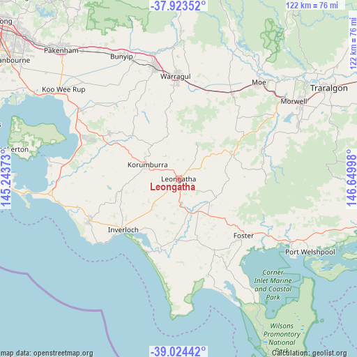
Leongatha GPS coordinates[2]
38° 28' 33.852" South, 145° 56' 48.66" East
| Map corner | latitude | longitude |
|---|---|---|
| Upper-left | -37.92352°, | 145.24373° |
| Center: | -38.47607°, | 145.94685° |
| Lower-right: | -39.02442°, | 146.64998° |
| Map W x H: | 122.4×122.4 km | = 76.1×76.1mi |
| max Lat: | -10.58257° ⇑95.9% North |
| Leongatha: | -38.47607° |
| min Lat: | ⇓4.1% South -43.31423° |
| min Long | Leongatha | max Long |
| 113.53327° | 145.94685° | 153.61246° |
| W 42.7%⇐ | ⇒57.3% E |
Elevation
Elevation of Leongatha is 92 m = 302 ft, and this is 30 m = 98 ft below average elevation for this country.
| Max E: |
1715 m = 5627 ft | 32.2% |
| Avg. | 122 m = 400 ft | |
| Leongatha | 92 m = 302 ft | |
Min E: |
-2 m = -7 ft | 67.8% |
See also: Australia elevation on elevation.city.
Geographical zone
Leongatha is located in South temperate zone (between Tropic of Capricorn and the Antarctic Circle). Distance of this Southern Tropic circle is 1672.2 km =1039.1 mi to North.| Distance of | km | miles | from Leongatha |
|---|---|---|---|
| Equator | 4278.1 | 2658.3 | to North |
| Tropic Capricorn | 1672.2 | 1039.1 | to North |
| Antarctic Circle | 3123 | 1940.5 | to South |
| South Pole | 5728.9 | 3559.8 | to South |


Nearby cities:
15 places around Leongatha: (largest is in red/bold)
• Boolarra
30.6 km =19 mi,  69°
69°
• Darnum
32.4 km =20.1 mi,  9°
9°
• Fish Creek
25.9 km =16.1 mi,  152°
152°
• Foster
29.5 km =18.3 mi,  131°
131°
• Inverloch
25.7 km =16 mi,  229°
229°
• Korumburra
11.8 km =7.3 mi,  294°
294°
• Loch
24 km =14.9 mi,  299°
299°
• Meeniyan
12.9 km =8 mi, 150°
• Mirboo North
20.5 km =12.7 mi, 65°
• North Wonthaggi
32.8 km =20.4 mi,  249°
249°
• Nyora
28.7 km =17.8 mi, 303°
• Poowong
21.8 km =13.5 mi,  312°
312°
• Venus Bay
27.2 km =16.9 mi,  203°
203°
• Wonthaggi
33.9 km =21.1 mi,  244°
244°
• Yarragon
31.7 km =19.7 mi,  18°
18°
Sources, notices
• [Note1] Compared only with cities in Australia existing in our database
• [Src1] Map data: © OpenStreetMap contributors (CC-BY-SA)
• [Src2] Other city data from geonames.org with taken over terms of usage.
• [Src3] Geographical zone / Annual Mean Temperature by Robert A. Rohde @ Wikipedia
