Nyora geodata
Nyora (Victoria) is a section of populated place; located in Australia in Australia/Melbourne (GMT+11) time zone. With population of 1,510 people, there are 3270 cities with bigger population in this country. Compared to other cities in Australia, 95% of cities are located further ↑North; 58.8% of cities are located further →East and 73.9% of cities have lower elevation than Nyora. Note1


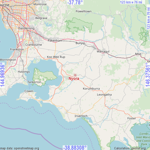
Nyora GPS coordinates[2]
38° 20' 1.104" South, 145° 40' 20.928" East
| Map corner | latitude | longitude |
|---|---|---|
| Upper-left | -37.78°, | 144.96936° |
| Center: | -38.33364°, | 145.67248° |
| Lower-right: | -38.88308°, | 146.37561° |
| Map W x H: | 122.7×122.6 km | = 76.2×76.2mi |
| max Lat: | -10.58257° ⇑95% North |
| Nyora: | -38.33364° |
| min Lat: | ⇓5% South -43.31423° |
| min Long | Nyora | max Long |
| 113.53327° | 145.67248° | 153.61246° |
| W 41.2%⇐ | ⇒58.8% E |
Elevation
Elevation of Nyora is 122 m = 400 ft, and this is 0 m = 0 ft above average elevation for this country.
| Max E: |
1715 m = 5627 ft | 26.1% |
| Nyora | 122 m 400 ft | |
| Avg. | 122 m = 400 ft | |
Min E: |
-2 m = -7 ft | 73.9% |
See also: Australia elevation on elevation.city.
Geographical zone
Nyora is located in South temperate zone (between Tropic of Capricorn and the Antarctic Circle). Distance of this Southern Tropic circle is 1656.4 km =1029.2 mi to North.| Distance of | km | miles | from Nyora |
|---|---|---|---|
| Equator | 4262.3 | 2648.5 | to North |
| Tropic Capricorn | 1656.4 | 1029.2 | to North |
| Antarctic Circle | 3138.9 | 1950.4 | to South |
| South Pole | 5744.8 | 3569.7 | to South |


Nearby cities:
15 places around Nyora: (largest is in red/bold)
• Bunyip
26.5 km =16.5 mi,  8°
8°
• Corinella
23.1 km =14.4 mi,  247°
247°
• Coronet Bay
23 km =14.3 mi,  239°
239°
• Dalyston
28 km =17.4 mi,  202°
202°
• Drouin
27.3 km =17 mi,  36°
36°
• Garfield
27.1 km =16.8 mi,  0°
0°
• Grantville
14.9 km =9.3 mi, 236°
• Koo-Wee-Rup
21.8 km =13.5 mi,  313°
313°
• Korumburra
17.1 km =10.6 mi,  129°
129°
• Lang Lang
12.2 km =7.6 mi, 307°
• Loch
5 km =3.1 mi,  141°
141°
• Longwarry
25.9 km =16.1 mi,  18°
18°
• North Wonthaggi
28 km =17.4 mi,  194°
194°
• Poowong
8 km =5 mi,  97°
97°
• Tooradin
28.5 km =17.7 mi,  297°
297°
Sources, notices
• [Note1] Compared only with cities in Australia existing in our database
• [Src1] Map data: © OpenStreetMap contributors (CC-BY-SA)
• [Src2] Other city data from geonames.org with taken over terms of usage.
• [Src3] Geographical zone / Annual Mean Temperature by Robert A. Rohde @ Wikipedia
