Gundagai geodata
Gundagai (New South Wales) is a populated place; located in Australia in Australia/Sydney (GMT+11) time zone. With population of 1,715 people, there are 3098 cities with bigger population in this country. Compared to other cities in Australia, 72.6% of cities are located further ↑North; 51.1% of cities are located further ←West and 83.7% of cities have lower elevation than Gundagai. Note1


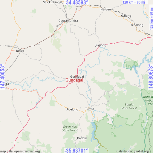
Gundagai GPS coordinates[2]
35° 3' 48.672" South, 148° 6' 13.14" East
| Map corner | latitude | longitude |
|---|---|---|
| Upper-left | -34.48598°, | 147.40053° |
| Center: | -35.06352°, | 148.10365° |
| Lower-right: | -35.63701°, | 148.80678° |
| Map W x H: | 128×128 km | = 79.5×79.5mi |
| max Lat: | -10.58257° ⇑72.6% North |
| Gundagai: | -35.06352° |
| min Lat: | ⇓27.4% South -43.31423° |
| min Long | Gundagai | max Long |
| 113.53327° | 148.10365° | 153.61246° |
| W 51.1%⇐ | ⇒48.9% E |
Elevation
Elevation of Gundagai is 226 m = 741 ft, and this is 104 m = 341 ft above average elevation for this country.
| Max E: |
1715 m = 5627 ft | 16.3% |
| Gundagai | 226 m 741 ft | |
| Avg. | 122 m = 400 ft | |
Min E: |
-2 m = -7 ft | 83.7% |
See also: Australia elevation on elevation.city.
Geographical zone
Gundagai is located in South temperate zone (between Tropic of Capricorn and the Antarctic Circle). Distance of this Southern Tropic circle is 1292.8 km =803.3 mi to North.| Distance of | km | miles | from Gundagai |
|---|---|---|---|
| Equator | 3898.7 | 2422.5 | to North |
| Tropic Capricorn | 1292.8 | 803.3 | to North |
| Antarctic Circle | 3502.5 | 2176.4 | to South |
| South Pole | 6108.4 | 3795.6 | to South |


Nearby cities:
15 places around Gundagai: (largest is in red/bold)
• Adelong
27 km =16.8 mi,  186°
186°
• Batlow
50.9 km =31.6 mi,  175°
175°
• Binalong
65.2 km =40.5 mi,  48°
48°
• Boorooma
67.3 km =41.8 mi,  268°
268°
• Charles Sturt University
68.2 km =42.4 mi, 270°
• Cootamundra
47.5 km =29.5 mi,  351°
351°
• Estella
67.9 km =42.2 mi, 269°
• Forest Hill
58.7 km =36.5 mi,  260°
260°
• Junee
52.2 km =32.4 mi,  294°
294°
• Kooringal
66.7 km =41.4 mi, 262°
• Lake Albert
66.5 km =41.3 mi, 260°
• South Gundagai
2.1 km =1.3 mi, 192°
• Tatton
68.6 km =42.6 mi, 261°
• Tumut
28.9 km =18 mi,  158°
158°
• Turvey Park
67.8 km =42.1 mi, 263°
Sources, notices
• [Note1] Compared only with cities in Australia existing in our database
• [Src1] Map data: © OpenStreetMap contributors (CC-BY-SA)
• [Src2] Other city data from geonames.org with taken over terms of usage.
• [Src3] Geographical zone / Annual Mean Temperature by Robert A. Rohde @ Wikipedia
