Adelong geodata
Adelong (New South Wales) is a populated place; located in Australia in Australia/Sydney (GMT+11) time zone. With population of 919 people, there are 3946 cities with bigger population in this country. Compared to other cities in Australia, 75.5% of cities are located further ↑North; 51% of cities are located further ←West and 89.4% of cities have lower elevation than Adelong. Note1


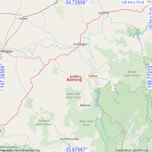
Adelong GPS coordinates[2]
35° 18' 17.64" South, 148° 4' 8.4" East
| Map corner | latitude | longitude |
|---|---|---|
| Upper-left | -34.72906°, | 147.36588° |
| Center: | -35.3049°, | 148.069° |
| Lower-right: | -35.87667°, | 148.77213° |
| Map W x H: | 127.6×127.6 km | = 79.3×79.3mi |
| max Lat: | -10.58257° ⇑75.5% North |
| Adelong: | -35.3049° |
| min Lat: | ⇓24.5% South -43.31423° |
| min Long | Adelong | max Long |
| 113.53327° | 148.069° | 153.61246° |
| W 51%⇐ | ⇒49% E |
Elevation
Elevation of Adelong is 356 m = 1168 ft, and this is 234 m = 768 ft above average elevation for this country.
| Max E: |
1715 m = 5627 ft | 10.6% |
| Adelong | 356 m 1168 ft | |
| Avg. | 122 m = 400 ft | |
Min E: |
-2 m = -7 ft | 89.4% |
See also: Australia elevation on elevation.city.
Geographical zone
Adelong is located in South temperate zone (between Tropic of Capricorn and the Antarctic Circle). Distance of this Southern Tropic circle is 1319.6 km =820 mi to North.| Distance of | km | miles | from Adelong |
|---|---|---|---|
| Equator | 3925.5 | 2439.2 | to North |
| Tropic Capricorn | 1319.6 | 820 | to North |
| Antarctic Circle | 3475.6 | 2159.6 | to South |
| South Pole | 6081.5 | 3778.9 | to South |


Nearby cities:
15 places around Adelong: (largest is in red/bold)
• Batlow
24.9 km =15.5 mi,  163°
163°
• Bourkelands
67.6 km =42 mi,  284°
284°
• Forest Hill
57.4 km =35.7 mi,  287°
287°
• Gundagai
27 km =16.8 mi,  6°
6°
• Junee
65.7 km =40.8 mi,  317°
317°
• Kooringal
65.5 km =40.7 mi, 286°
• Lake Albert
64.1 km =39.8 mi, 283°
• Mount Austin
67.7 km =42.1 mi, 286°
• South Gundagai
25 km =15.5 mi, 6°
• Tatton
66.5 km =41.3 mi, 284°
• Tolland
67.5 km =41.9 mi, 285°
• Tumbarumba
52.9 km =32.9 mi,  185°
185°
• Tumut
13.5 km =8.4 mi,  90°
90°
• Turvey Park
67.1 km =41.7 mi, 286°
• Wagga Wagga
68 km =42.3 mi, 287°
Sources, notices
• [Note1] Compared only with cities in Australia existing in our database
• [Src1] Map data: © OpenStreetMap contributors (CC-BY-SA)
• [Src2] Other city data from geonames.org with taken over terms of usage.
• [Src3] Geographical zone / Annual Mean Temperature by Robert A. Rohde @ Wikipedia
