Campbell Town geodata
Campbell Town (Tasmania) is a populated place; located in Australia in Australia/Hobart (GMT+11) time zone. With population of 982 people, there are 3854 cities with bigger population in this country. Compared to other cities in Australia, 98.1% of cities are located further ↑North; 50% of cities are located further ←West and 82.3% of cities have lower elevation than Campbell Town. Note1


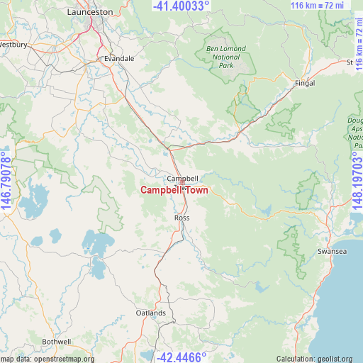
Campbell Town GPS coordinates[2]
41° 55' 32.196" South, 147° 29' 38.04" East
| Map corner | latitude | longitude |
|---|---|---|
| Upper-left | -41.40033°, | 146.79078° |
| Center: | -41.92561°, | 147.4939° |
| Lower-right: | -42.4466°, | 148.19703° |
| Map W x H: | 116.3×116.3 km | = 72.3×72.3mi |
| max Lat: | -10.58257° ⇑98.1% North |
| Campbell Town: | -41.92561° |
| min Lat: | ⇓1.9% South -43.31423° |
| min Long | Campbell Town | max Long |
| 113.53327° | 147.4939° | 153.61246° |
| W 50%⇐ | ⇒50% E |
Elevation
Elevation of Campbell Town is 209 m = 686 ft, and this is 87 m = 285 ft above average elevation for this country.
| Max E: |
1715 m = 5627 ft | 17.7% |
| Campbell Town | 209 m 686 ft | |
| Avg. | 122 m = 400 ft | |
Min E: |
-2 m = -7 ft | 82.3% |
See also: Australia elevation on elevation.city.
Geographical zone
Campbell Town is located in South temperate zone (between Tropic of Capricorn and the Antarctic Circle). Distance of this Southern Tropic circle is 2055.8 km =1277.4 mi to North.| Distance of | km | miles | from Campbell Town |
|---|---|---|---|
| Equator | 4661.7 | 2896.6 | to North |
| Tropic Capricorn | 2055.8 | 1277.4 | to North |
| Antarctic Circle | 2739.5 | 1702.2 | to South |
| South Pole | 5345.4 | 3321.5 | to South |


Nearby cities:
15 places around Campbell Town: (largest is in red/bold)
• Carrick
59.3 km =36.8 mi,  317°
317°
• Cressy
43.6 km =27.1 mi,  307°
307°
• Evandale
44.5 km =27.7 mi,  333°
333°
• Hadspen
58.7 km =36.5 mi, 323°
• Kings Meadows
57.6 km =35.8 mi, 331°
• Longford
47.3 km =29.4 mi, 318°
• Norwood
58 km =36 mi, 333°
• Oatlands
43.2 km =26.8 mi,  193°
193°
• Perth
47.5 km =29.5 mi, 325°
• Prospect Vale
59.1 km =36.7 mi, 326°
• Saint Leonards
57.6 km =35.8 mi, 334°
• South Launceston
59.8 km =37.2 mi, 331°
• Summerhill
59.3 km =36.8 mi, 329°
• Swansea
52.7 km =32.7 mi,  114°
114°
• Youngtown
56 km =34.8 mi, 331°
Sources, notices
• [Note1] Compared only with cities in Australia existing in our database
• [Src1] Map data: © OpenStreetMap contributors (CC-BY-SA)
• [Src2] Other city data from geonames.org with taken over terms of usage.
• [Src3] Geographical zone / Annual Mean Temperature by Robert A. Rohde @ Wikipedia
