Apple Tree Creek geodata
Apple Tree Creek (Queensland) is a populated place; located in Australia in Australia/Brisbane (GMT+10) time zone. With population of 643 people, there are 4465 cities with bigger population in this country. Compared to other cities in Australia, 89.5% of cities are located further ↓South; 83.4% of cities are located further ←West and 64.9% of cities have lower elevation than Apple Tree Creek. Note1


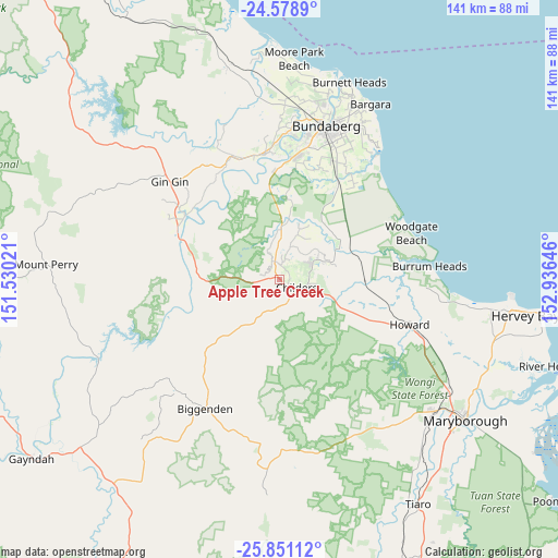
Apple Tree Creek GPS coordinates[2]
25° 13' 0.012" South, 152° 13' 59.988" East
| Map corner | latitude | longitude |
|---|---|---|
| Upper-left | -24.5789°, | 151.53021° |
| Center: | -25.21667°, | 152.23333° |
| Lower-right: | -25.85112°, | 152.93646° |
| Map W x H: | 141.5×141.5 km | = 87.9×87.9mi |
| max Lat: | -10.58257° ⇑10.5% North |
| Apple Tree Creek: | -25.21667° |
| min Lat: | ⇓89.5% South -43.31423° |
| min Long | Apple Tree Cree | max Long |
| 113.53327° | 152.23333° | 153.61246° |
| W 83.4%⇐ | ⇒16.6% E |
Elevation
Elevation of Apple Tree Creek is 80 m = 262 ft, and this is 42 m = 138 ft below average elevation for this country.
| Max E: |
1715 m = 5627 ft | 35.1% |
| Avg. | 122 m = 400 ft | |
| Apple Tree Creek | 80 m = 262 ft | |
Min E: |
-2 m = -7 ft | 64.9% |
See also: Australia elevation on elevation.city.
Geographical zone
Apple Tree Creek is located in South temperate zone (between Tropic of Capricorn and the Antarctic Circle). Distance of this Southern Tropic circle is 197.9 km =123 mi to North.| Distance of | km | miles | from Apple Tree Creek |
|---|---|---|---|
| Equator | 2803.8 | 1742.2 | to North |
| Tropic Capricorn | 197.9 | 123 | to North |
| Antarctic Circle | 4597.3 | 2856.6 | to South |
| South Pole | 7203.2 | 4475.9 | to South |


Nearby cities:
15 places around Apple Tree Creek: (largest is in red/bold)
• Biggenden
37.6 km =23.4 mi,  210°
210°
• Branyan
33.9 km =21.1 mi,  6°
6°
• Childers
5.1 km =3.2 mi,  116°
116°
• Gin Gin
37.2 km =23.1 mi,  311°
311°
• Howard
34.8 km =21.6 mi,  109°
109°
• Kensington
34.4 km =21.4 mi, 14°
• North Isis
5.4 km =3.4 mi,  35°
35°
• Norville
37.6 km =23.4 mi,  16°
16°
• Pacific Haven
32.5 km =20.2 mi,  99°
99°
• Redridge
13.9 km =8.6 mi,  68°
68°
• Sharon
38.1 km =23.7 mi, 5°
• South Bingera
27.7 km =17.2 mi,  357°
357°
• South Kolan
32.3 km =20.1 mi,  348°
348°
• Thabeban
37.1 km =23.1 mi, 18°
• Woodgate
35.3 km =21.9 mi, 70°
Sources, notices
• [Note1] Compared only with cities in Australia existing in our database
• [Src1] Map data: © OpenStreetMap contributors (CC-BY-SA)
• [Src2] Other city data from geonames.org with taken over terms of usage.
• [Src3] Geographical zone / Annual Mean Temperature by Robert A. Rohde @ Wikipedia
