Cape Paterson geodata
Cape Paterson (Victoria) is a populated place; located in Australia in Australia/Melbourne (GMT+11) time zone. With population of 846 people, there are 4067 cities with bigger population in this country. Compared to other cities in Australia, 96.2% of cities are located further ↑North; 59% of cities are located further →East and 68.6% of cities have higher elevation than Cape Paterson. Note1


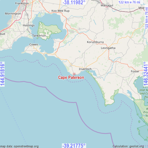
Cape Paterson GPS coordinates[2]
38° 40' 15.204" South, 145° 37' 16.608" East
| Map corner | latitude | longitude |
|---|---|---|
| Upper-left | -38.11982°, | 144.91816° |
| Center: | -38.67089°, | 145.62128° |
| Lower-right: | -39.21775°, | 146.32441° |
| Map W x H: | 122.1×122.1 km | = 75.9×75.9mi |
| max Lat: | -10.58257° ⇑96.2% North |
| Cape Paterson: | -38.67089° |
| min Lat: | ⇓3.8% South -43.31423° |
| min Long | Cape Paterson | max Long |
| 113.53327° | 145.62128° | 153.61246° |
| W 41%⇐ | ⇒59% E |
Elevation
Elevation of Cape Paterson is 24 m = 79 ft, and this is 98 m = 322 ft below average elevation for this country.
| Max E: |
1715 m = 5627 ft | 68.6% |
| Avg. | 122 m = 400 ft | |
| Cape Paterson | 24 m = 79 ft | |
Min E: |
-2 m = -7 ft | 31.4% |
See also: Australia elevation on elevation.city.
Geographical zone
Cape Paterson is located in South temperate zone (between Tropic of Capricorn and the Antarctic Circle). Distance of this Southern Tropic circle is 1693.9 km =1052.5 mi to North.| Distance of | km | miles | from Cape Paterson |
|---|---|---|---|
| Equator | 4299.8 | 2671.8 | to North |
| Tropic Capricorn | 1693.9 | 1052.5 | to North |
| Antarctic Circle | 3101.4 | 1927.1 | to South |
| South Pole | 5707.3 | 3546.4 | to South |


Nearby cities:
15 places around Cape Paterson: (largest is in red/bold)
• Cape Woolamai
28 km =17.4 mi,  300°
300°
• Corinella
33.1 km =20.6 mi,  329°
329°
• Coronet Bay
30 km =18.6 mi, 329°
• Dalyston
13.1 km =8.1 mi, 331°
• Grantville
30.4 km =18.9 mi,  344°
344°
• Inverloch
10.1 km =6.3 mi,  60°
60°
• Korumburra
31.9 km =19.8 mi,  33°
33°
• Leongatha
35.6 km =22.1 mi,  52°
52°
• Loch
34.4 km =21.4 mi,  12°
12°
• Meeniyan
36.1 km =22.4 mi,  73°
73°
• North Wonthaggi
10.6 km =6.6 mi,  346°
346°
• Rhyll
36.2 km =22.5 mi,  309°
309°
• San Remo
26.7 km =16.6 mi, 307°
• Venus Bay
17.8 km =11.1 mi,  100°
100°
• Wonthaggi
7.6 km =4.7 mi, 341°
Sources, notices
• [Note1] Compared only with cities in Australia existing in our database
• [Src1] Map data: © OpenStreetMap contributors (CC-BY-SA)
• [Src2] Other city data from geonames.org with taken over terms of usage.
• [Src3] Geographical zone / Annual Mean Temperature by Robert A. Rohde @ Wikipedia
