Hadrut geodata
Hadrut (Khojavend) is a populated place; located in Azerbaijan in Asia/Baku (GMT+4) time zone. With population of 2,523 people, there are 135 cities with bigger population in this country. Compared to other cities in Azerbaijan, 82.2% of cities are located further ↑North; 58.4% of cities are located further →East and 78.9% of cities have lower elevation than Hadrut. Note1


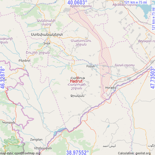
Hadrut GPS coordinates[2]
39° 31' 12.108" North, 47° 1' 54.84" East
| Map corner | latitude | longitude |
|---|---|---|
| Upper-left | 40.0603°, | 46.32878° |
| Center: | 39.52003°, | 47.0319° |
| Lower-right: | 38.97552°, | 47.73503° |
| Map W x H: | 120.6×120.6 km | = 74.9×74.9mi |
| max Lat: | 41.75259° ⇑82.2% North |
| Hadrut: | 39.52003° |
| min Lat: | ⇓17.8% South 38.45598° |
| min Long | Hadrut | max Long |
| 44.84846° | 47.0319° | 50.84003° |
| W 41.6%⇐ | ⇒58.4% E |
Elevation
Elevation of Hadrut is 733 m = 2405 ft, and this is 350 m = 1148 ft above average elevation for this country.
| Max E: |
2211 m = 7254 ft | 21.1% |
| Hadrut | 733 m 2405 ft | |
| Avg. | 383 m = 1257 ft | |
Min E: |
-26 m = -85 ft | 78.9% |
See also: Azerbaijan elevation on elevation.city.
Geographical zone
Hadrut is located in North temperate zone (between Tropic of Cancer and the Arctic Circle). Distance of this Northern Tropic circle is 1788.3 km =1111.2 mi to South.| Distance of | km | miles | from Hadrut |
|---|---|---|---|
| North Pole | 5612.8 | 3487.6 | to North |
| Arctic Circle | 3007 | 1868.5 | to North |
| Tropic Cancer | 1788.3 | 1111.2 | to South |
| Equator | 4394.2 | 2730.4 | to South |


Nearby cities:
15 places around Hadrut: (largest is in red/bold)
• Askyaran
49.6 km =30.8 mi,  339°
339°
• Ağdam
53.1 km =33 mi,  350°
350°
• Beylagan
57.7 km =35.9 mi,  60°
60°
• Fizuli
13.2 km =8.2 mi,  47°
47°
• Horadiz
27.1 km =16.8 mi,  106°
106°
• Jebrail
13.4 km =8.3 mi,  181°
181°
• Laçın
42.2 km =26.2 mi,  281°
281°
• Novyy Karanlug
31.3 km =19.4 mi,  12°
12°
• Qubadlı
43.3 km =26.9 mi,  243°
243°
• Qırmızı Bazar
18.7 km =11.6 mi, 338°
• Shushi
36 km =22.4 mi,  317°
317°
• Xankandi
40.8 km =25.4 mi, 324°
• Xocalı
48.3 km =30 mi,  334°
334°
• Yuxarı Aran
58.4 km =36.3 mi,  66°
66°
• Zangilan
58.1 km =36.1 mi,  213°
213°
Sources, notices
• [Note1] Compared only with cities in Azerbaijan existing in our database
• [Src1] Map data: © OpenStreetMap contributors (CC-BY-SA)
• [Src2] Other city data from geonames.org with taken over terms of usage.
• [Src3] Geographical zone / Annual Mean Temperature by Robert A. Rohde @ Wikipedia
