Sheki geodata
Sheki (Shaki City) is a seat of a first-order administrative division; located in Azerbaijan in Asia/Baku (GMT+4) time zone. With population of 63,000 people, there are 11 cities with bigger population in this country. Compared to other cities in Azerbaijan, 89.2% of cities are located further ↓South; 54.1% of cities are located further →East and 69.2% of cities have lower elevation than Sheki. Note1


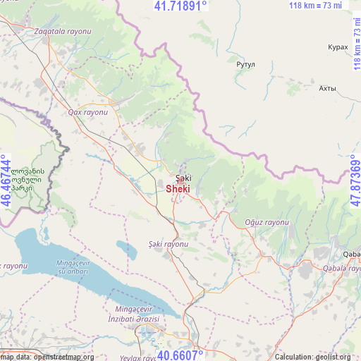
Sheki GPS coordinates[2]
41° 11' 30.984" North, 47° 10' 14.016" East
| Map corner | latitude | longitude |
|---|---|---|
| Upper-left | 41.71891°, | 46.46744° |
| Center: | 41.19194°, | 47.17056° |
| Lower-right: | 40.6607°, | 47.87369° |
| Map W x H: | 117.7×117.7 km | = 73.1×73.1mi |
| max Lat: | 41.75259° ⇑10.8% North |
| Sheki: | 41.19194° |
| min Lat: | ⇓89.2% South 38.45598° |
| min Long | Sheki | max Long |
| 44.84846° | 47.17056° | 50.84003° |
| W 45.9%⇐ | ⇒54.1% E |
Elevation
Elevation of Sheki is 549 m = 1801 ft, and this is 166 m = 545 ft above average elevation for this country.
| Max E: |
2211 m = 7254 ft | 30.8% |
| Sheki | 549 m 1801 ft | |
| Avg. | 383 m = 1257 ft | |
Min E: |
-26 m = -85 ft | 69.2% |
See also: Sheki elevation on elevation.city.
Geographical zone
Sheki is located in North temperate zone (between Tropic of Cancer and the Arctic Circle). Distance of this Northern Tropic circle is 1974.2 km =1226.7 mi to South.| Distance of | km | miles | from Sheki |
|---|---|---|---|
| North Pole | 5426.9 | 3372.1 | to North |
| Arctic Circle | 2821.1 | 1752.9 | to North |
| Tropic Cancer | 1974.2 | 1226.7 | to South |
| Equator | 4580.1 | 2845.9 | to South |


Nearby cities:
15 places around Sheki: (largest is in red/bold)
• Aliabad
55.2 km =34.3 mi,  305°
305°
• Aran
65.1 km =40.5 mi,  194°
194°
• Ağdaş
65.7 km =40.8 mi,  157°
157°
• Baş Göynük
15.6 km =9.7 mi,  342°
342°
• Faldarlı
62.7 km =39 mi,  299°
299°
• Mamrux
51.5 km =32 mi,  319°
319°
• Mingelchaur
48.5 km =30.1 mi, 191°
• Oğuz
28.1 km =17.5 mi,  118°
118°
• Qandax
61.3 km =38.1 mi, 300°
• Qax
32.7 km =20.3 mi, 320°
• Qax İngiloy
32.3 km =20.1 mi, 323°
• Qaxbaş
31.8 km =19.8 mi,  327°
327°
• Qutqashen
61.4 km =38.2 mi,  112°
112°
• Yevlakh
63.8 km =39.6 mi,  181°
181°
• Çinarlı
37.5 km =23.3 mi, 325°
Sources, notices
• [Note1] Compared only with cities in Azerbaijan existing in our database
• [Src1] Map data: © OpenStreetMap contributors (CC-BY-SA)
• [Src2] Other city data from geonames.org with taken over terms of usage.
• [Src3] Geographical zone / Annual Mean Temperature by Robert A. Rohde @ Wikipedia
