Qutqashen geodata
Qutqashen (Qǝbǝlǝ) is a seat of a first-order administrative division; located in Azerbaijan in Asia/Baku (GMT+4) time zone. With population of 11,867 people, there are 65 cities with bigger population in this country. Compared to other cities in Azerbaijan, 84.3% of cities are located further ↓South; 54.1% of cities are located further ←West and 81.1% of cities have lower elevation than Qutqashen. Note1


Qutqashen GPS coordinates[2]
40° 58' 56.892" North, 47° 50' 56.724" East
| Map corner | latitude | longitude |
|---|---|---|
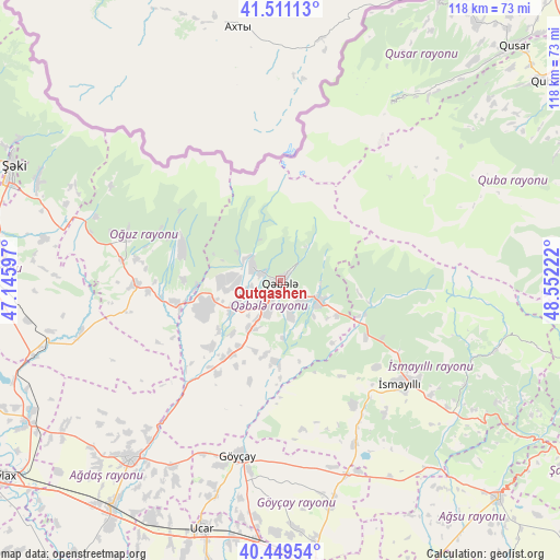
| Upper-left | 41.51113°, | 47.14597° |
| Center: | 40.98247°, | 47.84909° |
| Lower-right: | 40.44954°, | 48.55222° |
| Map W x H: | 118×118 km | = 73.3×73.3mi |
| max Lat: | 41.75259° ⇑15.7% North |
| Qutqashen: | 40.98247° |
| min Lat: | ⇓84.3% South 38.45598° |
| min Long | Qutqashen | max Long |
| 44.84846° | 47.84909° | 50.84003° |
| W 54.1%⇐ | ⇒45.9% E |
Elevation
Elevation of Qutqashen is 795 m = 2608 ft, and this is 412 m = 1352 ft above average elevation for this country.
| Max E: |
2211 m = 7254 ft | 18.9% |
| Qutqashen | 795 m 2608 ft | |
| Avg. | 383 m = 1257 ft | |
Min E: |
-26 m = -85 ft | 81.1% |
See also: Azerbaijan elevation on elevation.city.
Geographical zone
Qutqashen is located in North temperate zone (between Tropic of Cancer and the Arctic Circle). Distance of this Northern Tropic circle is 1950.9 km =1212.2 mi to South.| Distance of | km | miles | from Qutqashen |
|---|---|---|---|
| North Pole | 5450.2 | 3386.6 | to North |
| Arctic Circle | 2844.4 | 1767.4 | to North |
| Tropic Cancer | 1950.9 | 1212.2 | to South |
| Equator | 4556.8 | 2831.5 | to South |


Nearby cities:
15 places around Qutqashen: (largest is in red/bold)
• Aghsu
65.3 km =40.6 mi,  134°
134°
• Ağdaş
48.9 km =30.4 mi,  220°
220°
• Basqal
52.1 km =32.4 mi,  119°
119°
• Baş Göynük
72.5 km =45 mi,  301°
301°
• Geoktschai
38 km =23.6 mi,  193°
193°
• Kyurdarmir
75.7 km =47 mi,  159°
159°
• Lahıc
47.3 km =29.4 mi,  108°
108°
• Mingelchaur
70.7 km =43.9 mi,  249°
249°
• Oğuz
33.7 km =20.9 mi,  287°
287°
• Quba
69.7 km =43.3 mi,  52°
52°
• Qusar
69.4 km =43.1 mi,  44°
44°
• Sheki
61.4 km =38.2 mi, 292°
• Ujar
54.1 km =33.6 mi,  197°
197°
• Yevlakh
71.4 km =44.4 mi,  235°
235°
• İsmayıllı
33.6 km =20.9 mi, 130°
Sources, notices
• [Note1] Compared only with cities in Azerbaijan existing in our database
• [Src1] Map data: © OpenStreetMap contributors (CC-BY-SA)
• [Src2] Other city data from geonames.org with taken over terms of usage.
• [Src3] Geographical zone / Annual Mean Temperature by Robert A. Rohde @ Wikipedia
