Qax geodata
Qax (Qǝx) is a seat of a first-order administrative division; located in Azerbaijan in Asia/Baku (GMT+4) time zone. With population of 11,992 people, there are 64 cities with bigger population in this country. Compared to other cities in Azerbaijan, 91.9% of cities are located further ↓South; 63.2% of cities are located further →East and 70.8% of cities have lower elevation than Qax. Note1


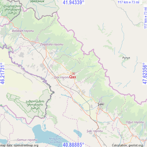
Qax GPS coordinates[2]
41° 25' 5.736" North, 46° 55' 13.548" East
| Map corner | latitude | longitude |
|---|---|---|
| Upper-left | 41.94339°, | 46.21731° |
| Center: | 41.41826°, | 46.92043° |
| Lower-right: | 40.88885°, | 47.62356° |
| Map W x H: | 117.3×117.3 km | = 72.9×72.9mi |
| max Lat: | 41.75259° ⇑8.1% North |
| Qax: | 41.41826° |
| min Lat: | ⇓91.9% South 38.45598° |
| min Long | Qax | max Long |
| 44.84846° | 46.92043° | 50.84003° |
| W 36.8%⇐ | ⇒63.2% E |
Elevation
Elevation of Qax is 590 m = 1936 ft, and this is 207 m = 679 ft above average elevation for this country.
| Max E: |
2211 m = 7254 ft | 29.2% |
| Qax | 590 m 1936 ft | |
| Avg. | 383 m = 1257 ft | |
Min E: |
-26 m = -85 ft | 70.8% |
See also: Azerbaijan elevation on elevation.city.
Geographical zone
Qax is located in North temperate zone (between Tropic of Cancer and the Arctic Circle). Distance of this Northern Tropic circle is 1999.4 km =1242.4 mi to South.| Distance of | km | miles | from Qax |
|---|---|---|---|
| North Pole | 5401.8 | 3356.5 | to North |
| Arctic Circle | 2795.9 | 1737.3 | to North |
| Tropic Cancer | 1999.4 | 1242.4 | to South |
| Equator | 4605.3 | 2861.6 | to South |


Nearby cities:
15 places around Qax: (largest is in red/bold)
• Aliabad
24.9 km =15.5 mi,  286°
286°
• Baş Göynük
19.1 km =11.9 mi,  122°
122°
• Belokany
54.9 km =34.1 mi,  308°
308°
• Faldarlı
34.2 km =21.3 mi,  279°
279°
• Mamrux
18.8 km =11.7 mi,  317°
317°
• Mingelchaur
73.7 km =45.8 mi,  170°
170°
• Oğuz
59.7 km =37.1 mi,  130°
130°
• Qabaqçöl
65.6 km =40.8 mi,  304°
304°
• Qandax
32.2 km =20 mi, 281°
• Qax İngiloy
1.6 km =1 mi,  66°
66°
• Qaxbaş
4 km =2.5 mi, 66°
• Qırmızı Samux
69.9 km =43.4 mi,  220°
220°
• Sheki
32.7 km =20.3 mi,  140°
140°
• Zaqatala
33 km =20.5 mi, 315°
• Çinarlı
5.7 km =3.5 mi,  356°
356°
Sources, notices
• [Note1] Compared only with cities in Azerbaijan existing in our database
• [Src1] Map data: © OpenStreetMap contributors (CC-BY-SA)
• [Src2] Other city data from geonames.org with taken over terms of usage.
• [Src3] Geographical zone / Annual Mean Temperature by Robert A. Rohde @ Wikipedia
