Qax İngiloy geodata
Qax İngiloy (Qǝx) is a populated place; located in Azerbaijan in Asia/Baku (GMT+4) time zone. With population of 2,747 people, there are 129 cities with bigger population in this country. Compared to other cities in Azerbaijan, 92.4% of cities are located further ↓South; 61.6% of cities are located further →East and 74.1% of cities have lower elevation than Qax İngiloy. Note1


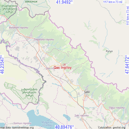
Qax İngiloy GPS coordinates[2]
41° 25' 26.832" North, 46° 56' 18.924" East
| Map corner | latitude | longitude |
|---|---|---|
| Upper-left | 41.9492°, | 46.23547° |
| Center: | 41.42412°, | 46.93859° |
| Lower-right: | 40.89476°, | 47.64172° |
| Map W x H: | 117.2×117.2 km | = 72.8×72.8mi |
| max Lat: | 41.75259° ⇑7.6% North |
| Qax İngiloy: | 41.42412° |
| min Lat: | ⇓92.4% South 38.45598° |
| min Long | Qax İngiloy | max Long |
| 44.84846° | 46.93859° | 50.84003° |
| W 38.4%⇐ | ⇒61.6% E |
Elevation
Elevation of Qax İngiloy is 656 m = 2152 ft, and this is 273 m = 896 ft above average elevation for this country.
| Max E: |
2211 m = 7254 ft | 25.9% |
| Qax İngiloy | 656 m 2152 ft | |
| Avg. | 383 m = 1257 ft | |
Min E: |
-26 m = -85 ft | 74.1% |
See also: Azerbaijan elevation on elevation.city.
Geographical zone
Qax İngiloy is located in North temperate zone (between Tropic of Cancer and the Arctic Circle). Distance of this Northern Tropic circle is 2000 km =1242.7 mi to South.| Distance of | km | miles | from Qax İngiloy |
|---|---|---|---|
| North Pole | 5401.1 | 3356.1 | to North |
| Arctic Circle | 2795.2 | 1736.9 | to North |
| Tropic Cancer | 2000 | 1242.7 | to South |
| Equator | 4605.9 | 2862 | to South |


Nearby cities:
15 places around Qax İngiloy: (largest is in red/bold)
• Aliabad
26.1 km =16.2 mi,  284°
284°
• Baş Göynük
18.2 km =11.3 mi,  126°
126°
• Belokany
55.7 km =34.6 mi,  307°
307°
• Faldarlı
35.6 km =22.1 mi, 278°
• Mamrux
19.4 km =12.1 mi, 312°
• Mingelchaur
74.1 km =46 mi,  172°
172°
• Oğuz
59 km =36.7 mi, 131°
• Qabaqçöl
66.5 km =41.3 mi,  303°
303°
• Qandax
33.6 km =20.9 mi, 279°
• Qax
1.6 km =1 mi,  246°
246°
• Qaxbaş
2.4 km =1.5 mi,  66°
66°
• Qırmızı Samux
71.4 km =44.4 mi,  221°
221°
• Sheki
32.3 km =20.1 mi,  143°
143°
• Zaqatala
33.6 km =20.9 mi, 313°
• Çinarlı
5.4 km =3.4 mi,  339°
339°
Sources, notices
• [Note1] Compared only with cities in Azerbaijan existing in our database
• [Src1] Map data: © OpenStreetMap contributors (CC-BY-SA)
• [Src2] Other city data from geonames.org with taken over terms of usage.
• [Src3] Geographical zone / Annual Mean Temperature by Robert A. Rohde @ Wikipedia
