Tongeren geodata
Tongeren (Flanders) is a populated place; located in Belgium in Europe/Brussels (GMT+2) time zone. With population of 29,816 people, there are 60 cities with bigger population in this country. Compared to other cities in Belgium, 51.1% of cities are located further ↑North; 83.2% of cities are located further ←West and 67.3% of cities have lower elevation than Tongeren. Note1
Administrative division(s):
- Level 1: Flanders
- Level 2: Provincie Limburg
- Level 3: Arrondissement Tongeren
- Level 4: Tongeren


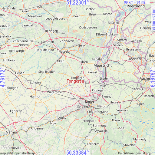
Tongeren GPS coordinates[2]
50° 46' 49.944" North, 5° 27' 53.424" East
| Map corner | latitude | longitude |
|---|---|---|
| Upper-left | 51.22301°, | 4.76172° |
| Center: | 50.78054°, | 5.46484° |
| Lower-right: | 50.33384°, | 6.16797° |
| Map W x H: | 98.9×98.9 km | = 61.5×61.5mi |
| max Lat: | 51.46791° ⇑51.1% North |
| Tongeren: | 50.78054° |
| min Lat: | ⇓48.9% South 49.53771° |
| min Long | Tongeren | max Long |
| 2.59368° | 5.46484° | 6.25749° |
| W 83.2%⇐ | ⇒16.8% E |
Elevation
Elevation of Tongeren is 107 m = 351 ft, and this is 7.5 m = 25 ft above average elevation for this country.
| Max E: |
582 m = 1909 ft | 32.7% |
| Tongeren | 107 m 351 ft | |
| Avg. | 99.5 m = 326 ft | |
Min E: |
1 m = 3 ft | 67.3% |
See also: Belgium elevation on elevation.city.
Geographical zone
Tongeren is located in North temperate zone (between Tropic of Cancer and the Arctic Circle). Distance of this North polar circle is 1754.9 km =1090.4 mi to North.| Distance of | km | miles | from Tongeren |
|---|---|---|---|
| North Pole | 4360.8 | 2709.7 | to North |
| Arctic Circle | 1754.9 | 1090.4 | to North |
| Tropic Cancer | 3040.3 | 1889.2 | to South |
| Equator | 5646.3 | 3508.4 | to South |


Nearby cities:
15 places around Tongeren: (largest is in red/bold)
• Ans
13.7 km =8.5 mi,  163°
163°
• Awans
12.5 km =7.8 mi,  180°
180°
• Bassenge
10.5 km =6.5 mi,  103°
103°
• Bilzen
11 km =6.8 mi,  20°
20°
• Borgloon
8.9 km =5.5 mi,  287°
287°
• Crisnée
8.5 km =5.3 mi,  213°
213°
• Diepenbeek
14.5 km =9 mi,  347°
347°
• Fexhe-le-Haut-Clocher
13.6 km =8.5 mi,  199°
199°
• Heers
11.8 km =7.3 mi,  255°
255°
• Hoeselt
7.6 km =4.7 mi,  12°
12°
• Juprelle
9.4 km =5.8 mi,  150°
150°
• Kortessem
10.2 km =6.3 mi,  328°
328°
• Oreye
10.8 km =6.7 mi,  229°
229°
• Riemst
10.1 km =6.3 mi,  71°
71°
• Wellen
11.1 km =6.9 mi,  307°
307°
In other languages:
- In France: Tongres
- In Italian: Tongres, Tongeren
- In Russian: Тонгерен
- In Chinese: 通厄伦
Sources, notices
• [Note1] Compared only with cities in Belgium existing in our database
• [Src1] Map data: © OpenStreetMap contributors (CC-BY-SA)
• [Src2] Other city data from geonames.org with taken over terms of usage.
• [Src3] Geographical zone / Annual Mean Temperature by Robert A. Rohde @ Wikipedia
