Fexhe-le-Haut-Clocher geodata
Fexhe-le-Haut-Clocher (Wallonia) is a populated place; located in Belgium in Europe/Brussels (GMT+2) time zone. With population of 3,082 people, there are 505 cities with bigger population in this country. Compared to other cities in Belgium, 62.6% of cities are located further ↑North; 81.2% of cities are located further ←West and 76.9% of cities have lower elevation than Fexhe-le-Haut-Clocher. Note1
Administrative division(s):
- Level 1: Wallonia
- Level 2: Province de Liège
- Level 3: Arrondissement de Waremme
- Level 4: Fexhe-le-Haut-Clocher
Current local time in Fexhe-le-Haut-Clocher:
09:46 AM, ThursdayDifference from your time zone: hours


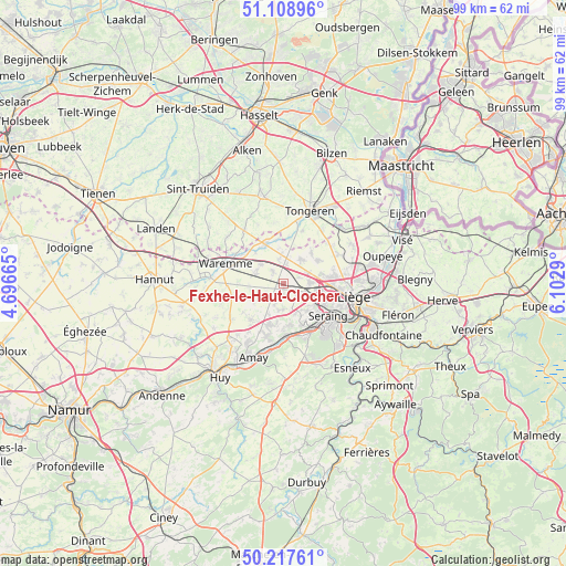
Fexhe-le-Haut-Clocher GPS coordinates[2]
50° 39' 55.44" North, 5° 23' 59.208" East
| Map corner | latitude | longitude |
|---|---|---|
| Upper-left | 51.10896°, | 4.69665° |
| Center: | 50.6654°, | 5.39978° |
| Lower-right: | 50.21761°, | 6.1029° |
| Map W x H: | 99.1×99.1 km | = 61.6×61.6mi |
| max Lat: | 51.46791° ⇑62.6% North |
| Fexhe-le-Haut-Clocher: | 50.6654° |
| min Lat: | ⇓37.4% South 49.53771° |
| min Long | Fexhe-le-Haut-C | max Long |
| 2.59368° | 5.39978° | 6.25749° |
| W 81.2%⇐ | ⇒18.8% E |
Elevation
Elevation of Fexhe-le-Haut-Clocher is 156 m = 512 ft, and this is 56.5 m = 185 ft above average elevation for this country.
| Max E: |
582 m = 1909 ft | 23.1% |
| Fexhe-le-Haut-Clocher | 156 m 512 ft | |
| Avg. | 99.5 m = 326 ft | |
Min E: |
1 m = 3 ft | 76.9% |
See also: Belgium elevation on elevation.city.
Geographical zone
Fexhe-le-Haut-Clocher is located in North temperate zone (between Tropic of Cancer and the Arctic Circle). Distance of this North polar circle is 1767.7 km =1098.4 mi to North.| Distance of | km | miles | from Fexhe-le-Haut-Clocher |
|---|---|---|---|
| North Pole | 4373.6 | 2717.6 | to North |
| Arctic Circle | 1767.7 | 1098.4 | to North |
| Tropic Cancer | 3027.5 | 1881.2 | to South |
| Equator | 5633.5 | 3500.5 | to South |


Nearby cities:
15 places around Fexhe-le-Haut-Clocher: (largest is in red/bold)
• Ans
8.5 km =5.3 mi,  92°
92°
• Awans
4.5 km =2.8 mi, 86°
• Crisnée
5.7 km =3.5 mi,  358°
358°
• Donceel
5.9 km =3.7 mi,  251°
251°
• Engis
9.3 km =5.8 mi,  180°
180°
• Faimes
9.9 km =6.2 mi,  268°
268°
• Flémalle-Haute
7.9 km =4.9 mi,  156°
156°
• Juprelle
10.4 km =6.5 mi,  63°
63°
• Mons-lez-Liège
7.2 km =4.5 mi,  138°
138°
• Oreye
6.8 km =4.2 mi,  328°
328°
• Remicourt
5.3 km =3.3 mi,  288°
288°
• Saint-Nicolas
10.2 km =6.3 mi,  113°
113°
• Seraing
11.6 km =7.2 mi, 141°
• Verlaine
8.7 km =5.4 mi,  222°
222°
• Waremme
10.8 km =6.7 mi, 289°
Sources, notices
• [Note1] Compared only with cities in Belgium existing in our database
• [Src1] Map data: © OpenStreetMap contributors (CC-BY-SA)
• [Src2] Other city data from geonames.org with taken over terms of usage.
• [Src3] Geographical zone / Annual Mean Temperature by Robert A. Rohde @ Wikipedia
