Wellen geodata
Wellen (Flanders) is a populated place; located in Belgium in Europe/Brussels (GMT+2) time zone. With population of 6,804 people, there are 399 cities with bigger population in this country. Compared to other cities in Belgium, 53.4% of cities are located further ↓South; 78.3% of cities are located further ←West and 51.3% of cities have higher elevation than Wellen. Note1
Administrative division(s):
- Level 1: Flanders
- Level 2: Provincie Limburg
- Level 3: Arrondissement Tongeren
- Level 4: Wellen


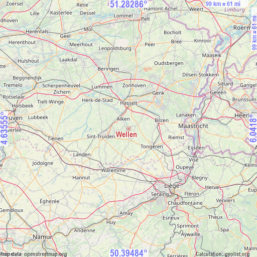
Wellen GPS coordinates[2]
50° 50' 27.456" North, 5° 20' 19.212" East
| Map corner | latitude | longitude |
|---|---|---|
| Upper-left | 51.28286°, | 4.63555° |
| Center: | 50.84096°, | 5.33867° |
| Lower-right: | 50.39484°, | 6.0418° |
| Map W x H: | 98.7×98.7 km | = 61.3×61.3mi |
| max Lat: | 51.46791° ⇑46.6% North |
| Wellen: | 50.84096° |
| min Lat: | ⇓53.4% South 49.53771° |
| min Long | Wellen | max Long |
| 2.59368° | 5.33867° | 6.25749° |
| W 78.3%⇐ | ⇒21.7% E |
Elevation
Elevation of Wellen is 47 m = 154 ft, and this is 52.5 m = 172 ft below average elevation for this country.
| Max E: |
582 m = 1909 ft | 51.3% |
| Avg. | 99.5 m = 326 ft | |
| Wellen | 47 m = 154 ft | |
Min E: |
1 m = 3 ft | 48.7% |
See also: Belgium elevation on elevation.city.
Geographical zone
Wellen is located in North temperate zone (between Tropic of Cancer and the Arctic Circle). Distance of this North polar circle is 1748.2 km =1086.3 mi to North.| Distance of | km | miles | from Wellen |
|---|---|---|---|
| North Pole | 4354.1 | 2705.5 | to North |
| Arctic Circle | 1748.2 | 1086.3 | to North |
| Tropic Cancer | 3047.1 | 1893.4 | to South |
| Equator | 5653 | 3512.6 | to South |


Nearby cities:
15 places around Wellen: (largest is in red/bold)
• Alken
4.5 km =2.8 mi,  328°
328°
• Bilzen
13.1 km =8.1 mi,  74°
74°
• Borgloon
4 km =2.5 mi,  174°
174°
• Crisnée
14.4 km =8.9 mi,  163°
163°
• Diepenbeek
9.3 km =5.8 mi,  37°
37°
• Hasselt
10 km =6.2 mi,  359°
359°
• Heers
10 km =6.2 mi,  194°
194°
• Hoeselt
10.5 km =6.5 mi,  86°
86°
• Kortessem
4.1 km =2.5 mi,  60°
60°
• Nieuwerkerken
10.4 km =6.5 mi,  284°
284°
• Oreye
13.7 km =8.5 mi,  177°
177°
• Sint-Joris
5.8 km =3.6 mi,  305°
305°
• Sint-Truiden
11 km =6.8 mi,  255°
255°
• Terkoest
7.7 km =4.8 mi, 325°
• Tongeren
11.1 km =6.9 mi,  127°
127°
Sources, notices
• [Note1] Compared only with cities in Belgium existing in our database
• [Src1] Map data: © OpenStreetMap contributors (CC-BY-SA)
• [Src2] Other city data from geonames.org with taken over terms of usage.
• [Src3] Geographical zone / Annual Mean Temperature by Robert A. Rohde @ Wikipedia
