Sint-Katelijne-Waver geodata
Sint-Katelijne-Waver (Flanders) is a populated place; located in Belgium in Europe/Brussels (GMT+2) time zone. With population of 19,487 people, there are 128 cities with bigger population in this country. Compared to other cities in Belgium, 77.6% of cities are located further ↓South; 51.8% of cities are located further →East and 96% of cities have higher elevation than Sint-Katelijne-Waver. Note1
Administrative division(s):
- Level 1: Flanders
- Level 2: Provincie Antwerpen
- Level 3: Arrondissement Mechelen
- Level 4: Sint-Katelijne-Waver


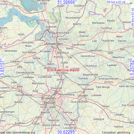
Sint-Katelijne-Waver GPS coordinates[2]
51° 4' 0.876" North, 4° 32' 4.884" East
| Map corner | latitude | longitude |
|---|---|---|
| Upper-left | 51.50666°, | 3.83157° |
| Center: | 51.06691°, | 4.53469° |
| Lower-right: | 50.62295°, | 5.23782° |
| Map W x H: | 98.3×98.3 km | = 61.1×61.1mi |
| max Lat: | 51.46791° ⇑22.4% North |
| Sint-Katelijne-Waver: | 51.06691° |
| min Lat: | ⇓77.6% South 49.53771° |
| min Long | Sint-Katelijne- | max Long |
| 2.59368° | 4.53469° | 6.25749° |
| W 48.2%⇐ | ⇒51.8% E |
Elevation
Elevation of Sint-Katelijne-Waver is 6 m = 20 ft, and this is 93.5 m = 307 ft below average elevation for this country.
| Max E: |
582 m = 1909 ft | 96% |
| Avg. | 99.5 m = 326 ft | |
| Sint-Katelijne-Waver | 6 m = 20 ft | |
Min E: |
1 m = 3 ft | 4% |
See also: Belgium elevation on elevation.city.
Geographical zone
Sint-Katelijne-Waver is located in North temperate zone (between Tropic of Cancer and the Arctic Circle). Distance of this North polar circle is 1723.1 km =1070.7 mi to North.| Distance of | km | miles | from Sint-Katelijne-Waver |
|---|---|---|---|
| North Pole | 4329 | 2689.9 | to North |
| Arctic Circle | 1723.1 | 1070.7 | to North |
| Tropic Cancer | 3072.2 | 1909 | to South |
| Equator | 5678.1 | 3528.2 | to South |


Nearby cities:
15 places around Sint-Katelijne-Waver: (largest is in red/bold)
• Berlaar
10.3 km =6.4 mi,  56°
56°
• Boechout
10.7 km =6.6 mi,  343°
343°
• Bonheiden
5 km =3.1 mi,  169°
169°
• Boom
11.7 km =7.3 mi,  283°
283°
• Boortmeerbeek
10.1 km =6.3 mi,  164°
164°
• Duffel
3.7 km =2.3 mi,  330°
330°
• Hove
10.7 km =6.6 mi, 335°
• Keerbergen
10 km =6.2 mi,  135°
135°
• Kontich
9.5 km =5.9 mi,  319°
319°
• Lier
7.6 km =4.7 mi,  19°
19°
• Lint
7.2 km =4.5 mi, 338°
• Mechelen
6.1 km =3.8 mi,  221°
221°
• Putte
7 km =4.3 mi,  102°
102°
• Rumst
8 km =5 mi, 281°
• Zemst
10.6 km =6.6 mi,  209°
209°
Sources, notices
• [Note1] Compared only with cities in Belgium existing in our database
• [Src1] Map data: © OpenStreetMap contributors (CC-BY-SA)
• [Src2] Other city data from geonames.org with taken over terms of usage.
• [Src3] Geographical zone / Annual Mean Temperature by Robert A. Rohde @ Wikipedia
