Rijkevorsel geodata
Rijkevorsel (Flanders) is a populated place; located in Belgium in Europe/Brussels (GMT+2) time zone. With population of 10,606 people, there are 290 cities with bigger population in this country. Compared to other cities in Belgium, 98.4% of cities are located further ↓South; 57.8% of cities are located further ←West and 67.3% of cities have higher elevation than Rijkevorsel. Note1
Administrative division(s):
- Level 1: Flanders
- Level 2: Provincie Antwerpen
- Level 3: Arrondissement Turnhout
- Level 4: Rijkevorsel


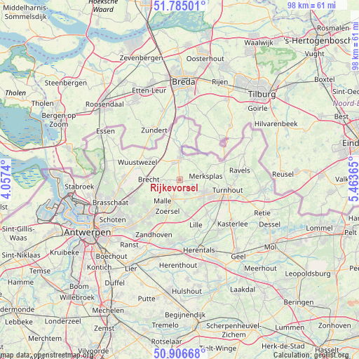
Rijkevorsel GPS coordinates[2]
51° 20' 52.62" North, 4° 45' 37.908" East
| Map corner | latitude | longitude |
|---|---|---|
| Upper-left | 51.78501°, | 4.0574° |
| Center: | 51.34795°, | 4.76053° |
| Lower-right: | 50.90668°, | 5.46365° |
| Map W x H: | 97.7×97.7 km | = 60.7×60.7mi |
| max Lat: | 51.46791° ⇑1.6% North |
| Rijkevorsel: | 51.34795° |
| min Lat: | ⇓98.4% South 49.53771° |
| min Long | Rijkevorsel | max Long |
| 2.59368° | 4.76053° | 6.25749° |
| W 57.8%⇐ | ⇒42.2% E |
Elevation
Elevation of Rijkevorsel is 24 m = 79 ft, and this is 75.5 m = 248 ft below average elevation for this country.
| Max E: |
582 m = 1909 ft | 67.3% |
| Avg. | 99.5 m = 326 ft | |
| Rijkevorsel | 24 m = 79 ft | |
Min E: |
1 m = 3 ft | 32.7% |
See also: Belgium elevation on elevation.city.
Geographical zone
Rijkevorsel is located in North temperate zone (between Tropic of Cancer and the Arctic Circle). Distance of this North polar circle is 1691.8 km =1051.2 mi to North.| Distance of | km | miles | from Rijkevorsel |
|---|---|---|---|
| North Pole | 4297.7 | 2670.5 | to North |
| Arctic Circle | 1691.8 | 1051.2 | to North |
| Tropic Cancer | 3103.4 | 1928.4 | to South |
| Equator | 5709.4 | 3547.7 | to South |


Nearby cities:
15 places around Rijkevorsel: (largest is in red/bold)
• Baarle-Hertog
11.1 km =6.9 mi,  55°
55°
• Beerse
7.2 km =4.5 mi,  116°
116°
• Brecht
8.5 km =5.3 mi,  271°
271°
• Hoogstraten
5.8 km =3.6 mi,  359°
359°
• Lille
12.6 km =7.8 mi,  159°
159°
• Merksplas
7.4 km =4.6 mi,  80°
80°
• Oostmalle
5.7 km =3.5 mi,  199°
199°
• Oud-Turnhout
15.8 km =9.8 mi,  101°
101°
• Ravels
16.3 km =10.1 mi, 80°
• Turnhout
13.1 km =8.1 mi, 102°
• Vorselaar
16.2 km =10.1 mi,  177°
177°
• Vosselaar
10 km =6.2 mi, 116°
• Wuustwezel
12.5 km =7.8 mi,  293°
293°
• Zandhoven
16.3 km =10.1 mi, 204°
• Zoersel
9.5 km =5.9 mi, 200°
Sources, notices
• [Note1] Compared only with cities in Belgium existing in our database
• [Src1] Map data: © OpenStreetMap contributors (CC-BY-SA)
• [Src2] Other city data from geonames.org with taken over terms of usage.
• [Src3] Geographical zone / Annual Mean Temperature by Robert A. Rohde @ Wikipedia
