Beerse geodata
Beerse (Flanders) is a populated place; located in Belgium in Europe/Brussels (GMT+2) time zone. With population of 16,208 people, there are 169 cities with bigger population in this country. Compared to other cities in Belgium, 97.3% of cities are located further ↓South; 60.3% of cities are located further ←West and 64.3% of cities have higher elevation than Beerse. Note1
Administrative division(s):
- Level 1: Flanders
- Level 2: Provincie Antwerpen
- Level 3: Arrondissement Turnhout
- Level 4: Beerse


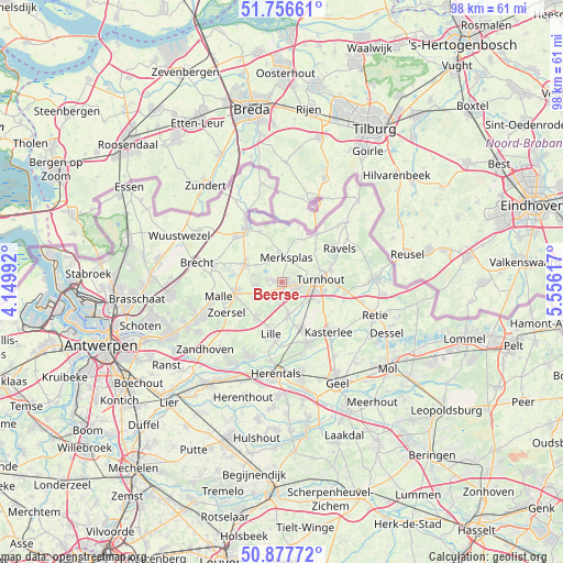
Beerse GPS coordinates[2]
51° 19' 9.372" North, 4° 51' 10.944" East
| Map corner | latitude | longitude |
|---|---|---|
| Upper-left | 51.75661°, | 4.14992° |
| Center: | 51.31927°, | 4.85304° |
| Lower-right: | 50.87772°, | 5.55617° |
| Map W x H: | 97.7×97.7 km | = 60.7×60.7mi |
| max Lat: | 51.46791° ⇑2.7% North |
| Beerse: | 51.31927° |
| min Lat: | ⇓97.3% South 49.53771° |
| min Long | Beerse | max Long |
| 2.59368° | 4.85304° | 6.25749° |
| W 60.3%⇐ | ⇒39.7% E |
Elevation
Elevation of Beerse is 27 m = 89 ft, and this is 72.5 m = 238 ft below average elevation for this country.
| Max E: |
582 m = 1909 ft | 64.3% |
| Avg. | 99.5 m = 326 ft | |
| Beerse | 27 m = 89 ft | |
Min E: |
1 m = 3 ft | 35.7% |
See also: Belgium elevation on elevation.city.
Geographical zone
Beerse is located in North temperate zone (between Tropic of Cancer and the Arctic Circle). Distance of this North polar circle is 1695 km =1053.2 mi to North.| Distance of | km | miles | from Beerse |
|---|---|---|---|
| North Pole | 4300.9 | 2672.5 | to North |
| Arctic Circle | 1695 | 1053.2 | to North |
| Tropic Cancer | 3100.2 | 1926.4 | to South |
| Equator | 5706.2 | 3545.7 | to South |


Nearby cities:
15 places around Beerse: (largest is in red/bold)
• Baarle-Hertog
9.9 km =6.2 mi,  15°
15°
• Brecht
15.3 km =9.5 mi,  282°
282°
• Herentals
15.9 km =9.9 mi,  185°
185°
• Hoogstraten
11.1 km =6.9 mi,  324°
324°
• Kasterlee
11.7 km =7.3 mi,  137°
137°
• Lille
8.8 km =5.5 mi, 193°
• Merksplas
4.4 km =2.7 mi,  10°
10°
• Oostmalle
8.6 km =5.3 mi,  255°
255°
• Oud-Turnhout
9.1 km =5.7 mi,  89°
89°
• Ravels
11.3 km =7 mi,  58°
58°
• Rijkevorsel
7.2 km =4.5 mi,  296°
296°
• Turnhout
6.4 km =4 mi, 86°
• Vorselaar
14.1 km =8.8 mi,  203°
203°
• Vosselaar
2.8 km =1.7 mi,  115°
115°
• Zoersel
11.3 km =7 mi,  239°
239°
Sources, notices
• [Note1] Compared only with cities in Belgium existing in our database
• [Src1] Map data: © OpenStreetMap contributors (CC-BY-SA)
• [Src2] Other city data from geonames.org with taken over terms of usage.
• [Src3] Geographical zone / Annual Mean Temperature by Robert A. Rohde @ Wikipedia
