Lommel geodata
Lommel (Flanders) is a populated place; located in Belgium in Europe/Brussels (GMT+2) time zone. With population of 31,993 people, there are 50 cities with bigger population in this country. Compared to other cities in Belgium, 93.7% of cities are located further ↓South; 77.4% of cities are located further ←West and 50.9% of cities have higher elevation than Lommel. Note1
Administrative division(s):
- Level 1: Flanders
- Level 2: Provincie Limburg
- Level 3: Arrondissement Maaseik
- Level 4: Lommel


Lommel GPS coordinates[2]
51° 13' 50.664" North, 5° 18' 48.564" East
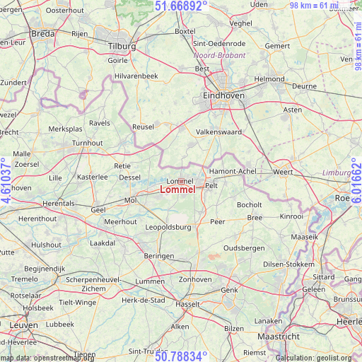
| Map corner | latitude | longitude |
|---|---|---|
| Upper-left | 51.66892°, | 4.61037° |
| Center: | 51.23074°, | 5.31349° |
| Lower-right: | 50.78834°, | 6.01662° |
| Map W x H: | 97.9×97.9 km | = 60.8×60.8mi |
| max Lat: | 51.46791° ⇑6.3% North |
| Lommel: | 51.23074° |
| min Lat: | ⇓93.7% South 49.53771° |
| min Long | Lommel | max Long |
| 2.59368° | 5.31349° | 6.25749° |
| W 77.4%⇐ | ⇒22.6% E |
Elevation
Elevation of Lommel is 48 m = 157 ft, and this is 51.5 m = 169 ft below average elevation for this country.
| Max E: |
582 m = 1909 ft | 50.9% |
| Avg. | 99.5 m = 326 ft | |
| Lommel | 48 m = 157 ft | |
Min E: |
1 m = 3 ft | 49.1% |
See also: Belgium elevation on elevation.city.
Geographical zone
Lommel is located in North temperate zone (between Tropic of Cancer and the Arctic Circle). Distance of this North polar circle is 1704.8 km =1059.3 mi to North.| Distance of | km | miles | from Lommel |
|---|---|---|---|
| North Pole | 4310.7 | 2678.5 | to North |
| Arctic Circle | 1704.8 | 1059.3 | to North |
| Tropic Cancer | 3090.4 | 1920.3 | to South |
| Equator | 5696.3 | 3539.5 | to South |


Nearby cities:
15 places around Lommel: (largest is in red/bold)
• Arendonk
19 km =11.8 mi,  302°
302°
• Balen
12.2 km =7.6 mi,  235°
235°
• Beringen
21.1 km =13.1 mi,  196°
196°
• Bocholt
19.6 km =12.2 mi,  108°
108°
• Bree
22.1 km =13.7 mi,  116°
116°
• Dessel
13.9 km =8.6 mi,  273°
273°
• Helchteren
20 km =12.4 mi,  166°
166°
• Heusden
21.7 km =13.5 mi,  186°
186°
• Leopoldsburg
13.4 km =8.3 mi, 199°
• Meerhout
19.7 km =12.2 mi, 236°
• Mol
14.4 km =8.9 mi,  252°
252°
• Neerpelt
9 km =5.6 mi,  91°
91°
• Overpelt
7.5 km =4.7 mi, 107°
• Peer
15.1 km =9.4 mi,  137°
137°
• Retie
16.6 km =10.3 mi,  283°
283°
Sources, notices
• [Note1] Compared only with cities in Belgium existing in our database
• [Src1] Map data: © OpenStreetMap contributors (CC-BY-SA)
• [Src2] Other city data from geonames.org with taken over terms of usage.
• [Src3] Geographical zone / Annual Mean Temperature by Robert A. Rohde @ Wikipedia
