Jalhay geodata
Jalhay (Wallonia) is a populated place; located in Belgium in Europe/Brussels (GMT+2) time zone. With population of 7,688 people, there are 378 cities with bigger population in this country. Compared to other cities in Belgium, 72.9% of cities are located further ↑North; 97.8% of cities are located further ←West and 96.4% of cities have lower elevation than Jalhay. Note1
Administrative division(s):
- Level 1: Wallonia
- Level 2: Province de Liège
- Level 3: Arrondissement de Verviers
- Level 4: Jalhay


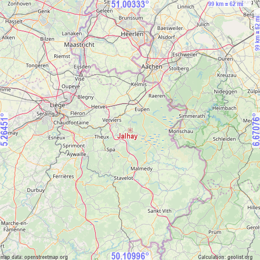
Jalhay GPS coordinates[2]
50° 33' 31.536" North, 5° 58' 3.504" East
| Map corner | latitude | longitude |
|---|---|---|
| Upper-left | 51.00333°, | 5.26451° |
| Center: | 50.55876°, | 5.96764° |
| Lower-right: | 50.10996°, | 6.67076° |
| Map W x H: | 99.3×99.3 km | = 61.7×61.7mi |
| max Lat: | 51.46791° ⇑72.9% North |
| Jalhay: | 50.55876° |
| min Lat: | ⇓27.1% South 49.53771° |
| min Long | Jalhay | max Long |
| 2.59368° | 5.96764° | 6.25749° |
| W 97.8%⇐ | ⇒2.2% E |
Elevation
Elevation of Jalhay is 386 m = 1266 ft, and this is 286.5 m = 940 ft above average elevation for this country.
| Max E: |
582 m = 1909 ft | 3.6% |
| Jalhay | 386 m 1266 ft | |
| Avg. | 99.5 m = 326 ft | |
Min E: |
1 m = 3 ft | 96.4% |
See also: Belgium elevation on elevation.city.
Geographical zone
Jalhay is located in North temperate zone (between Tropic of Cancer and the Arctic Circle). Distance of this North polar circle is 1779.6 km =1105.8 mi to North.| Distance of | km | miles | from Jalhay |
|---|---|---|---|
| North Pole | 4385.5 | 2725 | to North |
| Arctic Circle | 1779.6 | 1105.8 | to North |
| Tropic Cancer | 3015.7 | 1873.9 | to South |
| Equator | 5621.6 | 3493.1 | to South |


Nearby cities:
15 places around Jalhay: (largest is in red/bold)
• Baelen
8.1 km =5 mi,  3°
3°
• Dison
9.9 km =6.2 mi,  305°
305°
• Eupen
9.1 km =5.7 mi,  32°
32°
• Herve
15.3 km =9.5 mi, 306°
• Limbourg
6.2 km =3.9 mi,  342°
342°
• Lontzen
13.9 km =8.6 mi,  11°
11°
• Malmédy
15.3 km =9.5 mi,  163°
163°
• Olne
16 km =9.9 mi,  282°
282°
• Pepinster
11.6 km =7.2 mi, 278°
• Raeren
15.9 km =9.9 mi,  40°
40°
• Soumagne
16.8 km =10.4 mi,  291°
291°
• Spa
11 km =6.8 mi,  220°
220°
• Theux
11.3 km =7 mi,  255°
255°
• Verviers
8.2 km =5.1 mi, 294°
• Welkenraedt
11.3 km =7 mi, 0°
Sources, notices
• [Note1] Compared only with cities in Belgium existing in our database
• [Src1] Map data: © OpenStreetMap contributors (CC-BY-SA)
• [Src2] Other city data from geonames.org with taken over terms of usage.
• [Src3] Geographical zone / Annual Mean Temperature by Robert A. Rohde @ Wikipedia
